Everest Base Camp Trek – A Visual Journey to the Land of Sherpas
The Everest base camp trek had been on my list for the last 4-5 years. Due to office and family commitments, it was difficult to get leave for 20 days to attempt this trek. The Corona pandemic also derailed the plans for 2 years. However, in April 2022, I was lucky to finally get all things sorted and was embarking on this wonderful trek.
Following are a few factual information and tips for anyone who would wish to attempt this trek.
- Trek gradient – moderate to tough
- The gradient is steep mostly during the second part of the day, after lunch
- Hiking above 4,000 meters, after Tengboche, is tougher due to the higher altitude
- A good amount of physical fitness is required. Read the blog here to get fit.
- Number of days – 16 nights and 17 days. You can take a helicopter from the base camp, which will reduce the hike distance by 3-4 days.
- Absolute things to carry – Hiking shoes, thermals, jackets, polaroid glasses. Read here for the complete list of things to carry for the trek.
- Cash Required – carry around Rs 10,000 (USD 122). Indian currency is accepted mostly everywhere in Nepal.
- Network connectivity – International roaming will work at few locations. You can take a local sim from Kathmandu. For the internet, you can take Everest Link satellite wifi from the tea houses you stay at. Will cost around Rs 100 to Rs 500 for 24 hours.
- Food – almost all types of foods are available – even pizza, burgers and momos! However, don’t eat heavy food or non-veg. Eat lite vegetarian foods, fruits, and daal bhaath for a better digestive system and experience. The food is very expensive on the trail.
- The Pricing – Opt for an all-inclusive package – like what TrekNomads provides. Trekking companies, which sell this trek at Rs 38,000 hides a lot of things from you. For example food (Rs 15,000 to 20,000 extra), Water (yes water) is chargeable (Rs 2,000 to 3,000), Kathmandu to Lukla flights (Rs 30,000+), blankets (Rs 200 per night), Types of rooms/hotels, and friendly staff (Priceless!). So if you take a cheaper package, not only you will pay a lot higher in the end, you will have a not so good experience.
Day 0 – Bangalore to Kathmandu
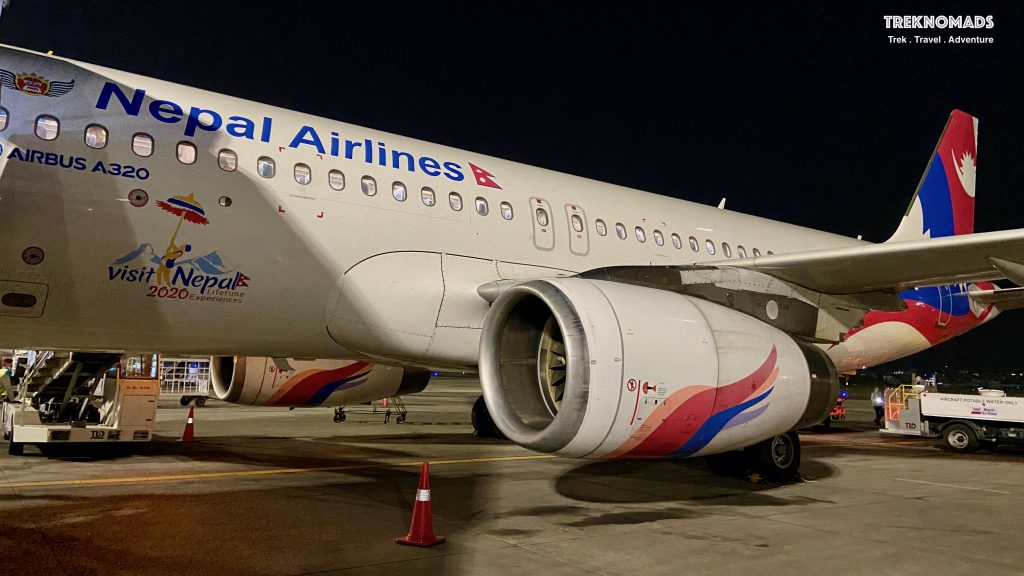
The beautiful Nepal Airlines plane. Our flight was from Bangalore around 6 pm. We reached Kathmandu around 9:30 pm. Nepal time is 15 mins ahead of IST. The aircraft was good and they served us a hot meal during our flight.
Day 1: Kathmandu to Lukla
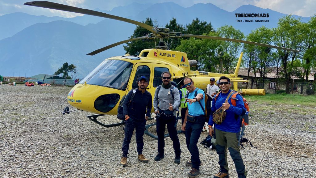
Reached Lukla: After settling in our hotel around 10:30 pm the previous night, we got up early in the morning for our flight to Lukla. The flight was supposed to be a small 20+ seater aeroplane from Kathmandu domestic airport. We waited from 6 am in the morning till 11 am. Later we were told that all flights to Lukla have been cancelled due to high winds around Lukla. So, we had to arrange a helicopter ride (at extra cost), to reach Lukla. Reaching Lukla the same day was important, as we did not want to waste an extra day. Also, we were not sure of the weather the next day. Our guide promptly arranged 4 helicopters for our group.
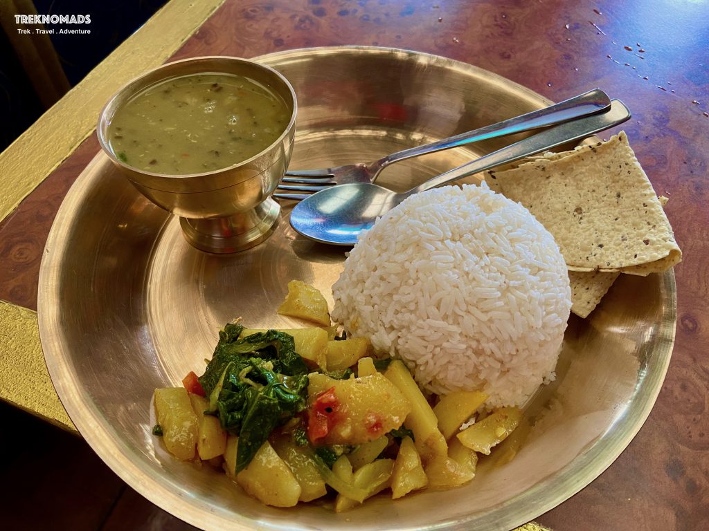
Daal Bhaath: This is a staple food in Nepal. A typical meal of Daal Bhaath consists of Arhar daal + steamed rice + papad + pickle + lots of vegetables (including greens and aloo). This is very filling, tasty and also nutritious with a good amount of fibre, carbs and protein.
Day 2: Lukla to Namche Bazaar via Phakding
Lukla to Phakding: The next morning, we woke up around 5:30 am and by 6:30 am, we started our hike towards Namche Bazaar via Phakding. Since our last group the previous day had reached late in the evening (from Kathmandu), we had decided to halt at Lukla. However, since we had lost a day, we decided to hike directly to Namche Bazaar from Lukla. The initial part of the trail is mostly downhill with a well-laid trail and small tea houses on the trail.
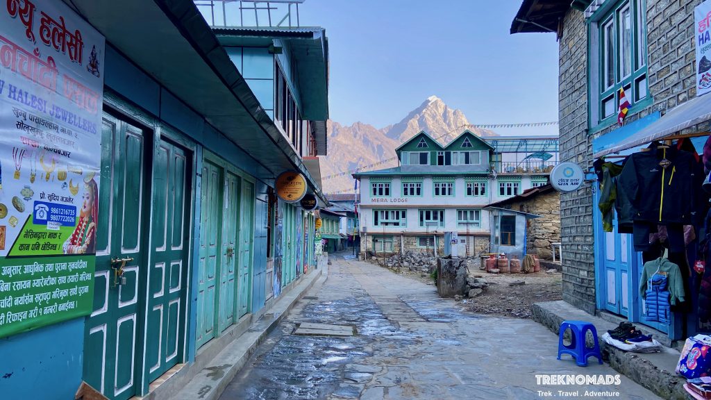
The trail from Lukla to Phakding: The group really enjoyed the early morning hike. Since it was mostly downhill and in shade, we were walking faster. This pace and saved time was required for the later part of the day, when the trail is steeper after Phakding.
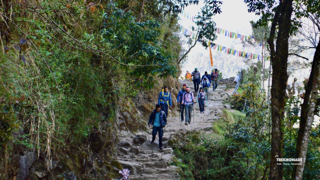
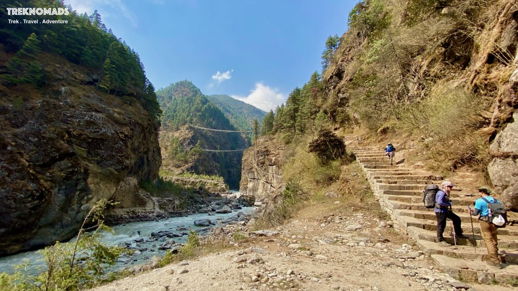
Steep steps before Hillary Bridge: After lunch at Jorshalle, the climb was steeper and we were gaining altitude. Before the gruelling climb to Namche, we come across these steep stairs to the famous Hillary Bridge. With full stomach of daal baath, this trail was excruciatingly painful and took us almost 2-3 hours.
Tea House at Namche Bazaar: After a tough day of nearly 10 hours of hike, we finally reached Namche Bazaar. Immediately we went to the restaurant in our tea house and decided to have a hot ginger lemon tea.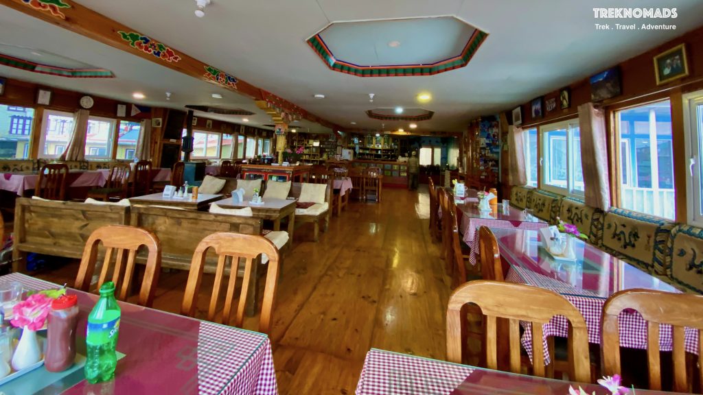
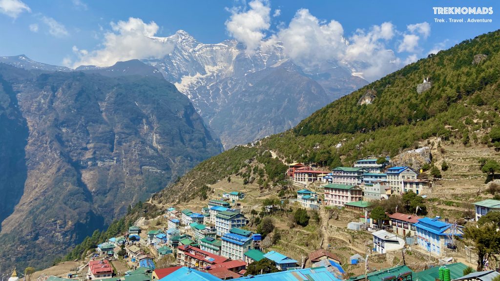
Namche Bazaar: The view from Namche Bazaar. Namche Bazaar is at an altitude of ~3,400 meters above sea level. This is a famous Sherpa Village and is the gateway to the Everest Region. Even during the first Everest Expeditions in the 1950s, this route was taken by Sir Edmund Hillary, Eric Shipton and other climbers. This town is bustling with modern activities and amenities like spas, massage, cafes, and bars. They even have their own NorthFace store!
Day 3: Acclimatisation to Everest View Hotel
Acclimatisation day at Namche Bazaar:
Acclimatisation is important if you wish to avoid acute mountain sickness (AMS).
We stay at namche bazaar and take rest. This day we went for an 8-10 km hike to Everest View Hotel which is at a height of around 3,800 meters above sea level. The trail is steep from the start. The initial part is climbing stairs to the top of Namche Village. Post that there is a steep incline towards the hotel. After 2 km of climb, we come across a trail which is mostly gradual. We get very good views of Ama Dablam, Lhotse, Nuptse and even Everest – if the weather is good.
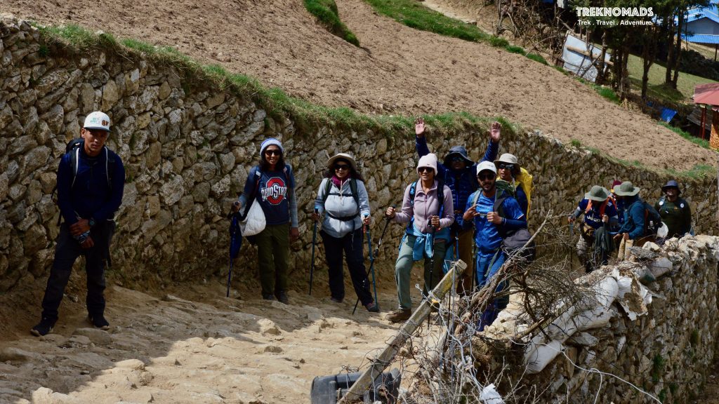
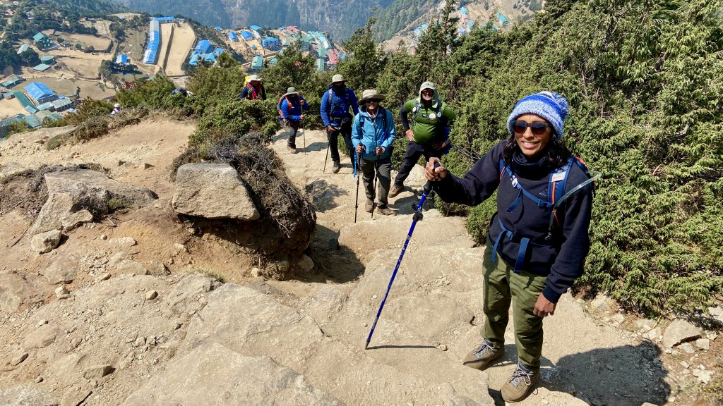
As we climb higher on the trail, we start getting full view of the Namche Village. The surrounding mountains start looking bigger. The initial part of the hike is very steep. But with good company, its fun.
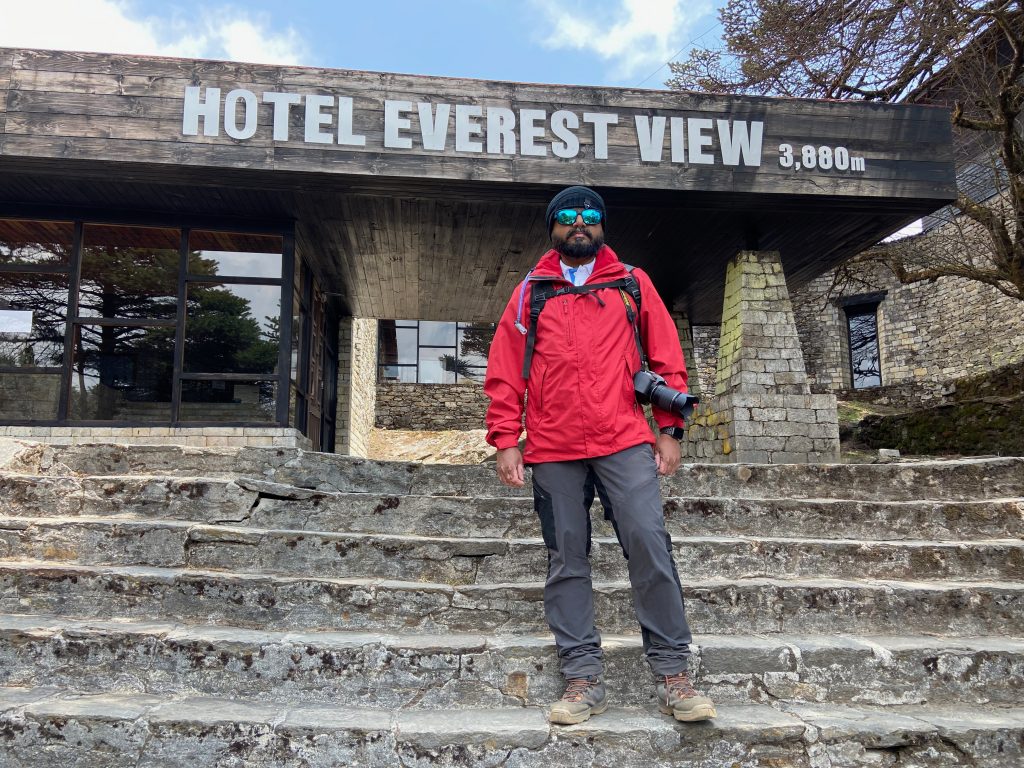
Hotel Everest View (3,880 Meters). This hotel has a balcony view of the Everest range of mountains. We were unlucky as the weather was not on our side and it was cloudy in the mountains. The hotel has a few very good pics of the region. It serves continental snacks, however, their service is a little slow due to the influx of visitors.
Day 4: Namche Bazaar to Tengoche
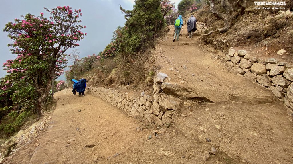
Namche Bazaar to Tyangboche: Namche Bazaar to Tyangboche is around 9 Kms trek. The altitude gain is from ~3,400 Meters to ~3,870 Meters. The trail is very beautiful and is surrounded by rhododendron trees. During the spring season, the trail is laden with beautiful red and white flowers. The trail is a gentle hike for the first 1/3rd of the trail. The trail descends as we go further, till we reach a rope bridge. This is generally where we had our lunch. After lunch, the trail suddenly starts ascending. The last part of the trail is very steep and tiring.
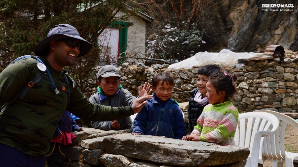
Rhododendron Tree enroute Tengboche. These flowers generally bloom in the spring season. The flowers give a very vibrant feel to the entire route.
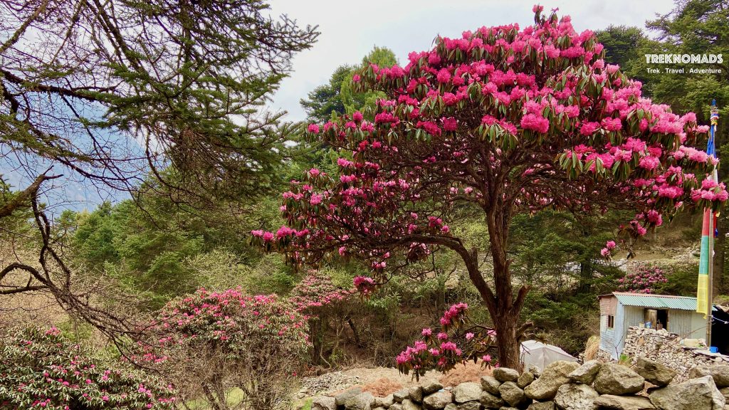
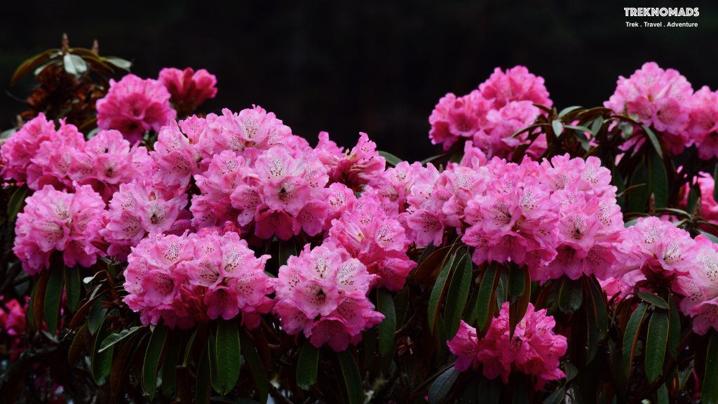
Rhododendron Flowers: Rhododendron means “Rose Tree” in Greek. The trek route from Namche Bazaar to Tengboche is covered with these flowers. The entire route is very scenic. There are 2-3 variations of these flowers.
The climb to Tengboche: After our lunch, when our stomachs were full with Daal Baath, we started on the gruelling climb after crossing the bridge on the Dudh Koshi River. The climb is around 2 Km. However, it is very steep. There is a well-laid trail. But altitude, inclination and full stomach made it very hard to climb. The route is extremely scenic. It was cloudy and misty, so we could not see the entire valley and surrounding mountains.
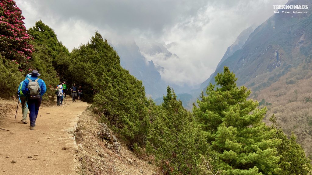
The trail to Tengboche after the Dudh Koshi river bridge is very steep and zig-zag. The climb is very tiring. However, the views are breathtakingly beautiful.
Day 5: Tengoche to Dengboche
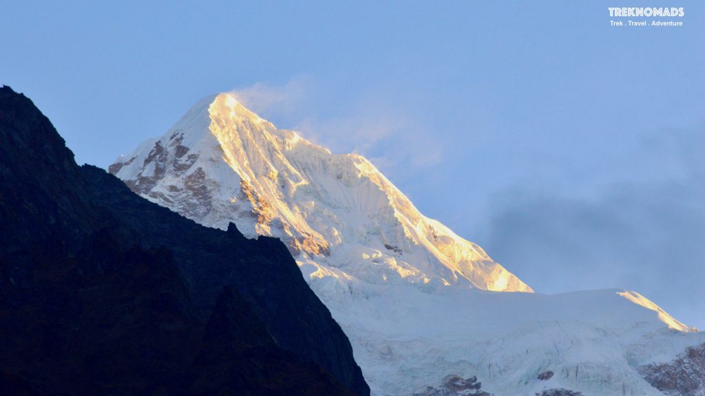
The morning golden glow on Kusum Kanguru mountain as seen from Tengboche.
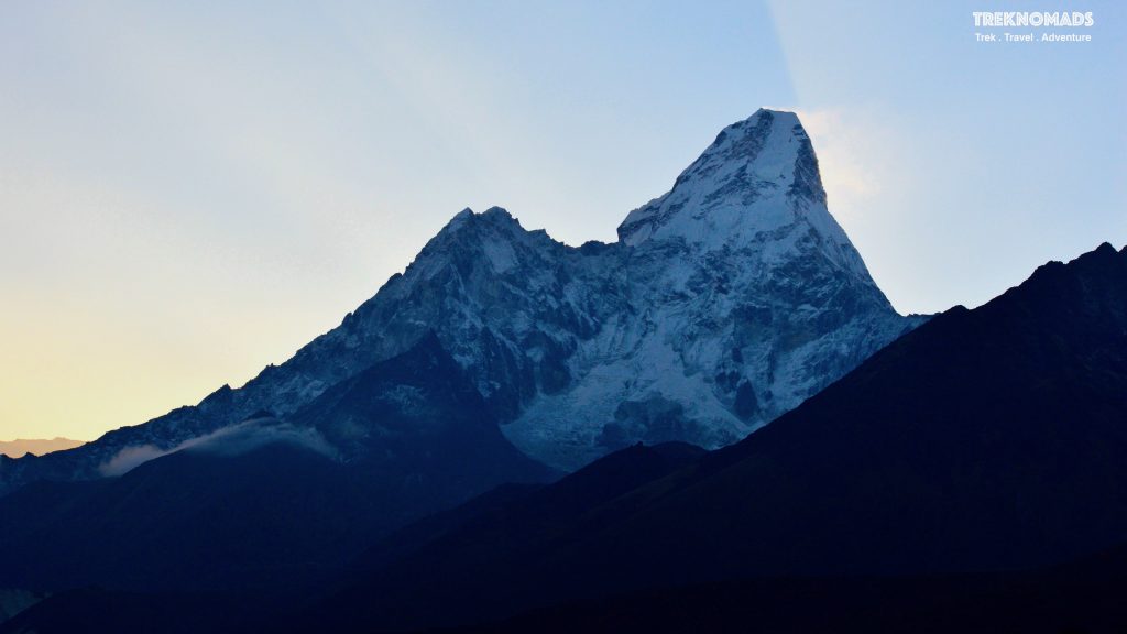
Mount Ama Dablam. One of the most impressive mountains in the trek route. In Nepali culture, the mountain means a mother holding her kid. The direct translation of Ama Dablam is “mother’s necklace”. This mountain is also called, “The Matterhorn of the Himalayas. We get amazing views of this mountain from Tengboche. The views get even better as we reach Dingboche.
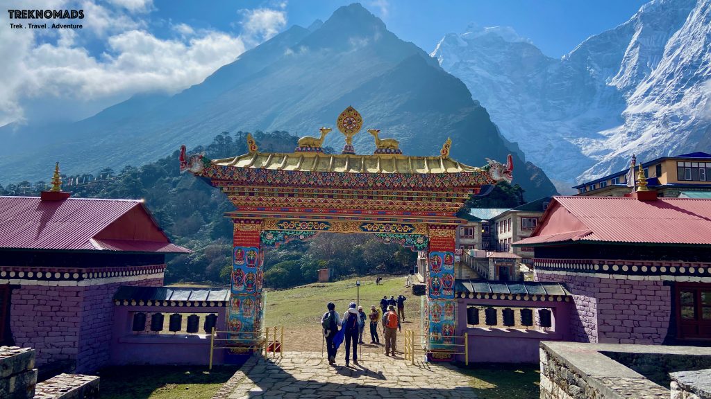
Tengboche Monastery is also known as Dawa Choling Gompa. This is one of the oldest and highest monasteries in the world at a height of around 3,867 meters above sea level. The monastery is closely linked with the Rongbuk Monastery in Tibet. This is one of the most beautiful and peaceful places on earth.
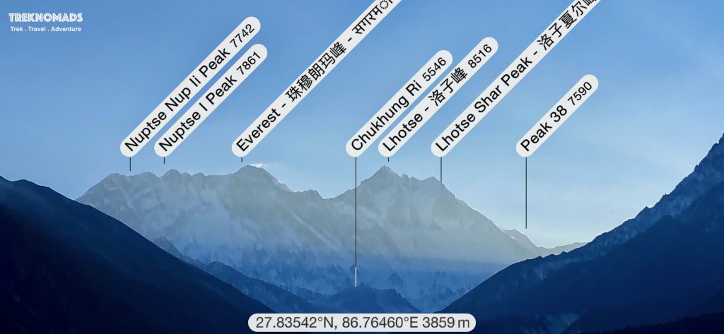
Imagine waking up to a view like this. 3 of the top mountains in the world are in front of you. The photo does not do justice to what we saw in front of us. It was a surreal experience.
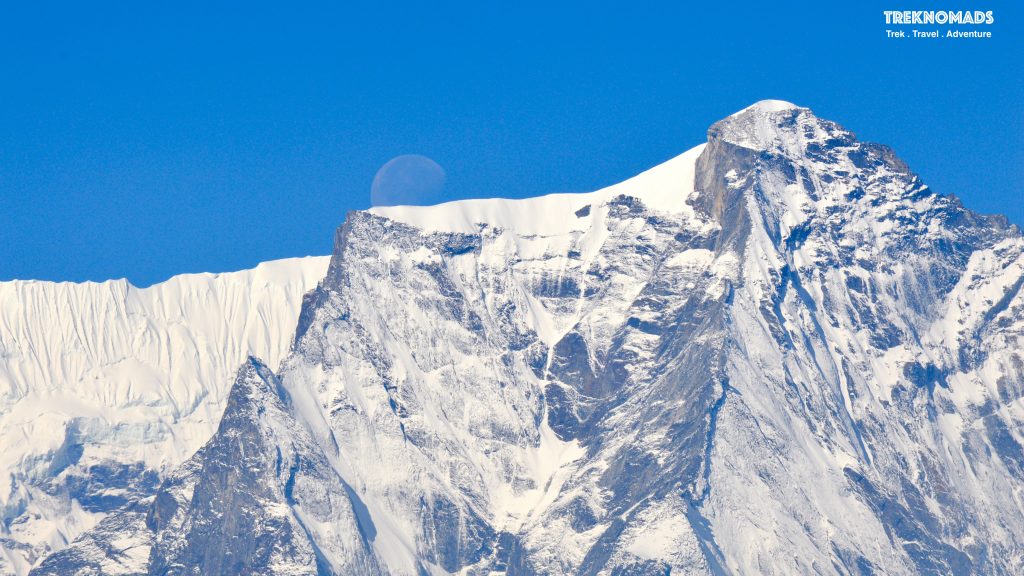
This is one of my favourite pics. The silhouette of the moonset behind mighty white peaks in the morning. Tengboche offers amazing views of mountains all around. We see Everest, Lhotse, Nuptse, Ama Dablam, Kusum Kanguru, Kangtega, Chamlang, Tobuche and other unknown majestic peaks.
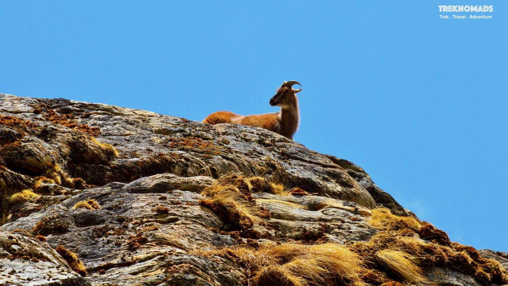
A beautiful Himalayan goral. These guys are the real climbers. They generally herd in the grass found on the rocky slopes. They can climb almost vertically without trekking shoes or ropes! 🙂 We encountered around 5-6 groups of these animals right from Namche Bazaar. They are very calm and gave us plenty of opportunities to photograph them.
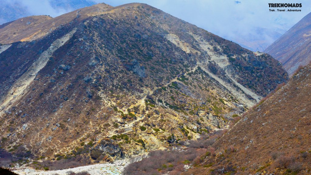
Once we leave Tengboche, we descend for 2-3 km and cross another bridge on the Dudh Koshi river. We cross Deboche, Pengboche and had lunch at Somare. So far the trail is mostly flat with occasional descends and ascends. After Somare, the trail is mostly flat, till we reach another river crossing. After the crossing, we come across this massive climb. At the height of 4,000+ meters (plus a heavy portion of Daal Baath), this climb was a tough one for me. We mostly crawled to reach the top. Once we reach the top, there is a gentle decline towards Dingboche. Which was our destination for the next 2 days.
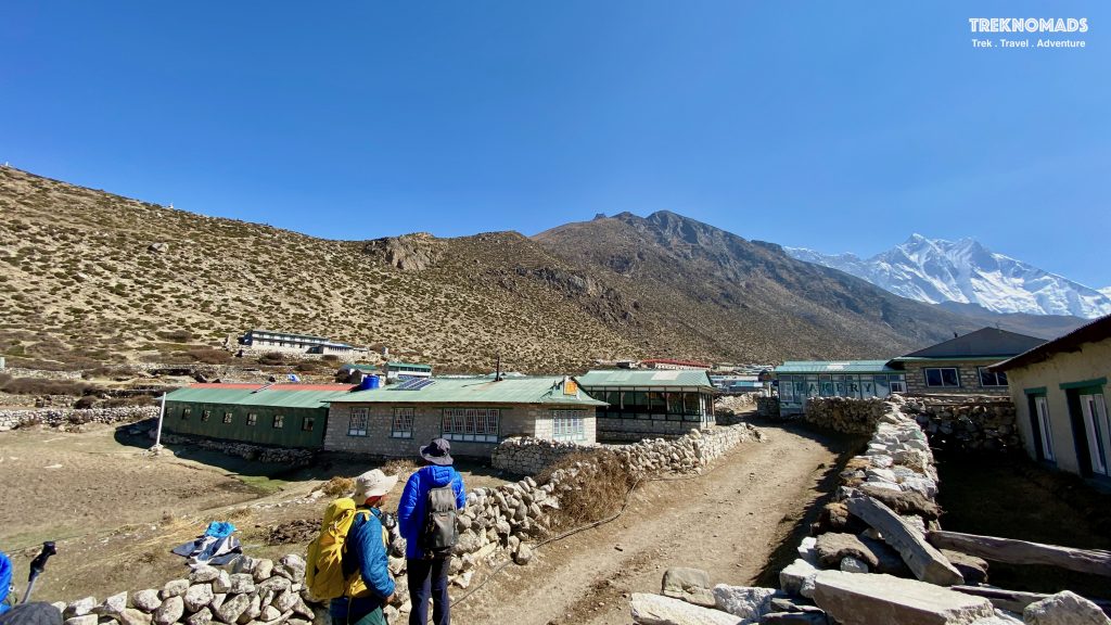
Dingboche Village is around 4,400 meters above sea level. This village is right under the Ama Dablam mountain and offers full views of majestic white peaks all around it. We can see Lhotse, Nuptse, Ama Dablam, Island Peak, Makalu and many other peaks. The village has good facilities like coffee bars, good food, internet, electricity and even shower facilities – all at extra costs.
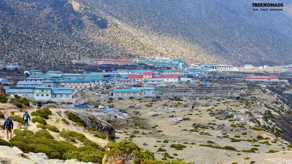
Day 6: Acclimatisation climb to Nangkartshang Peak
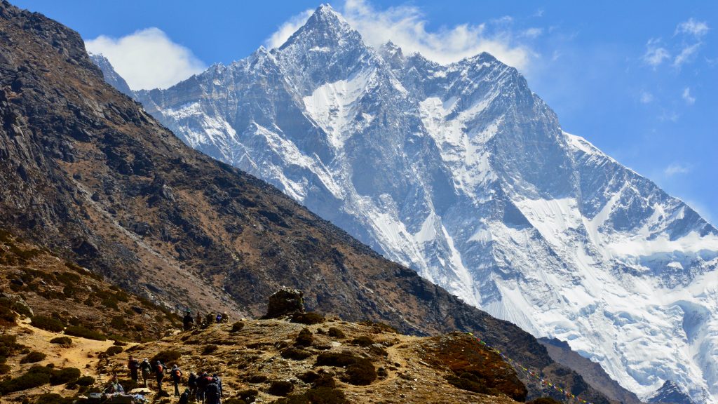
We spent our second day of acclimatisation at Dingboche. A refreshing breakfast while admiring a looming Ama Dablam (6,856m) to the south is fantastic. To better appreciate Mt Ama Dablam, Mt Lhotse and numerous other peaks visible from Dingboche, we climb the ridge on the north behind the village. This will be an ideal acclimatising excursion. We can see three of the world’s six highest peaks, Mt Lhotse, Mt Makalu, and Mt Cho Oyu. To the west, loom the towering peaks of Cholatse (6440m) and Taboche (6542m).
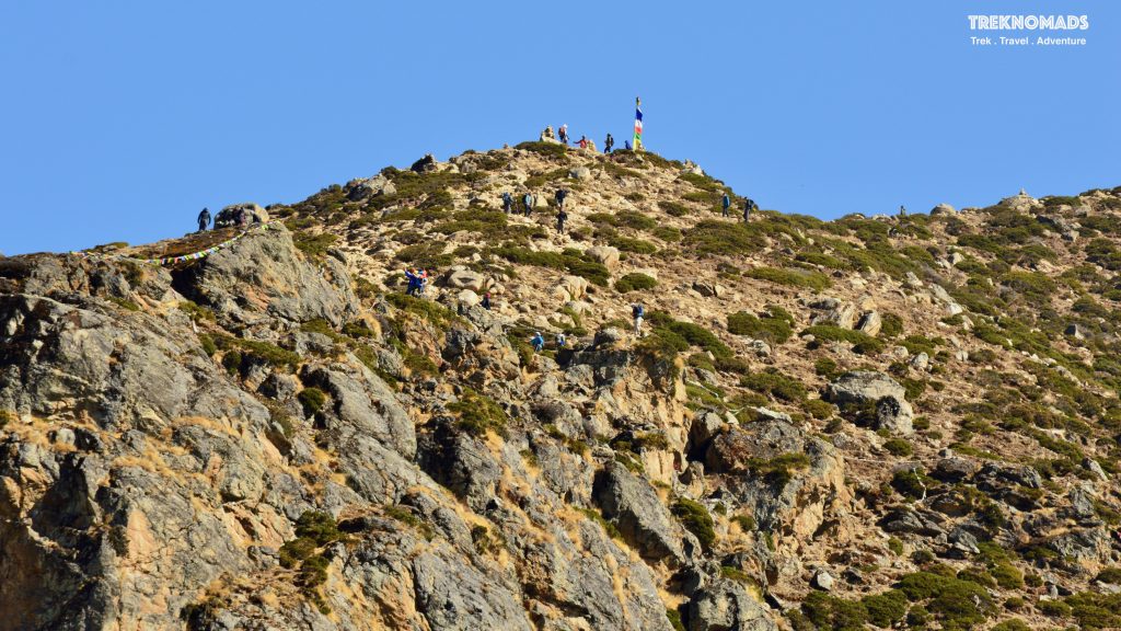
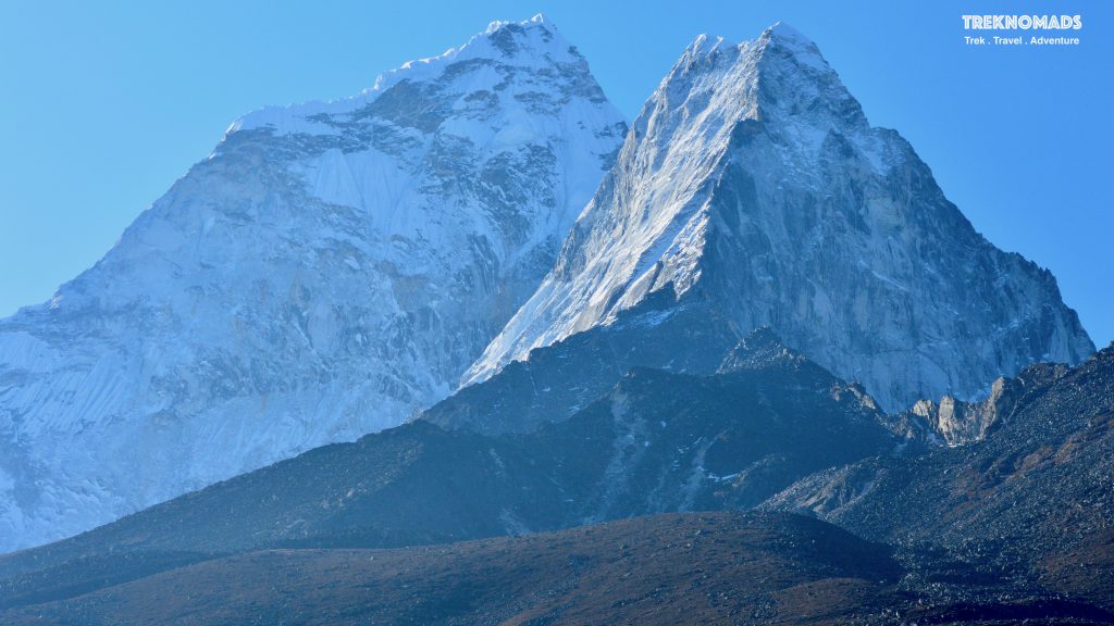
The Dingboche village is nearly in the foothills of the mighty Ama Dablam. The weather is generally clear in the mornings till the afternoon. We got really awesome views from 5:30 am onwards. It was really meditative to look at this motherlike goddess.
The team climbing towards the Nangkartshang Peak. This is part of the acclimatisation trek on day 2 at Dingboche. The peak is around 5,000 meters. There are 3-4 stops where you can climb depending on fitness and weather conditions. The views are spectacular – of Ama Dablam (6812m), Makalu (8485m), Lhotse (8516m), Kantega(6782m) and Cho Oyu (6160m). Surprisingly, Everest peak is not visible from here. The trail is easy but will test your strength due to the steady incline throughout.
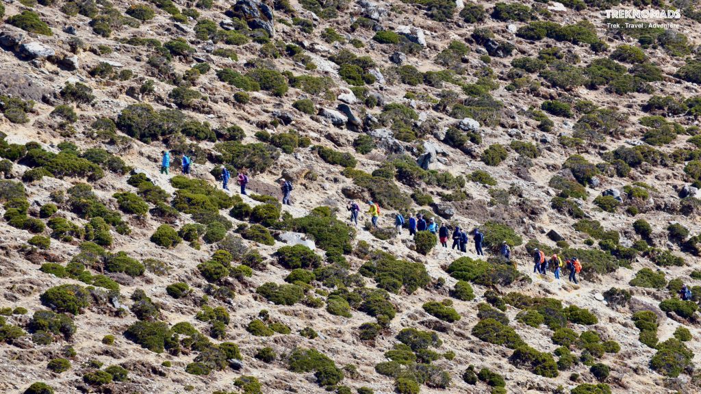
On our way to Nangkartshang Peak. The weather was very good early in the morning. However, when we reached the 2nd view point, it became very windy and cold. This peak offers a balcony seat window to Ama Dablam and various other peaks in the region.
Day 7: Dengboche to Lobuche
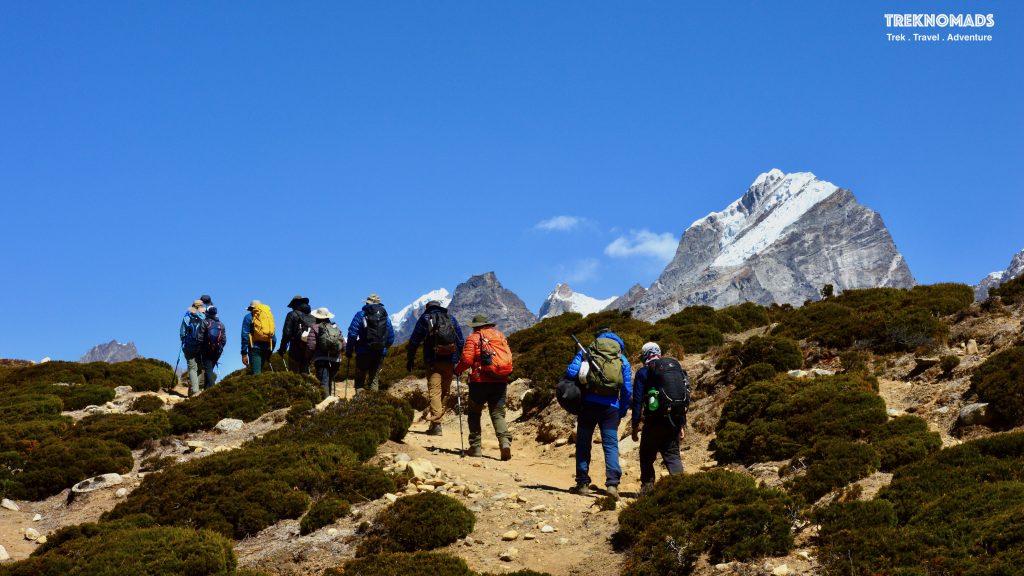
The next day, we started our trek towards the Lobuche village (~5,000 meters). The climb is mostly moderate. The initial route after crossing a ridge near Dengboche is mostly slow uphill. Once we reach Thukla-Dhukla, there is a steep climb for 45 mins to an hour. Post that there is the decline and gradual walk till Lobuche.
The view of mountains from the Dingboche ridge. On a clear day, we see Mount Makalu as well. The famous Island Peak – which is mostly a trekking peak, is also seen in the pic.
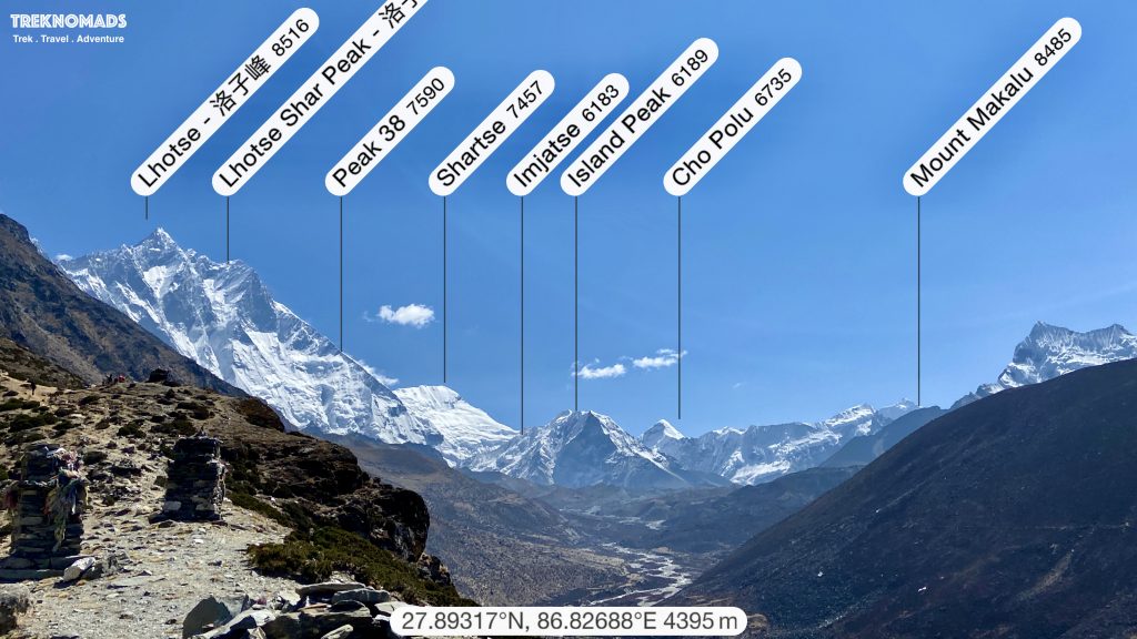
The trek towards Lobuche from Dingboche. The views are spectacular. Behind – towards Dingboche – we can see the mighty Ama Dablam, towards left we see Tobuche (6,459 M) and Cholatse (6,440 M). These two mountains are seen till Everest Base Camp on a clear day. We also get to see the summit of Cho Yu in the front, from certain points.
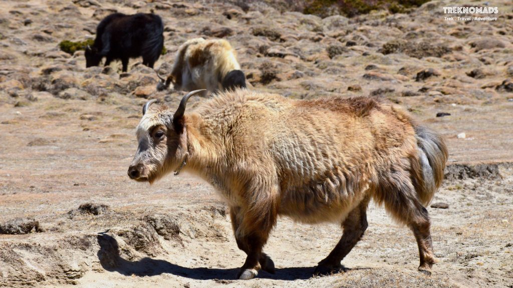
The local Sherpa community generally call the males of the species “Yak” and the females “Nak”, or “Dri”. Yaks are the lifeline of the Everest Base Camp route – and other routes in the Nepal Himalayas. Very gentle and beautiful animals. In a few regions in Nepal, the Yak blood drinking festival is celebrated. Fresh yak blood is drawn and drunk. The locals believe this will cure diseases. A similar custom is also found in Africa – where certain tribes drink cow blood.
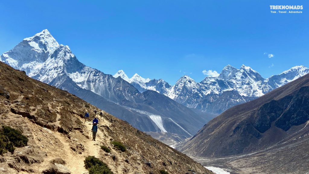
The Dingboche to Lobuche trek route. This pic is just before we reach the Thukla water stream crossing. The mountain on the left is Ama Dablam.
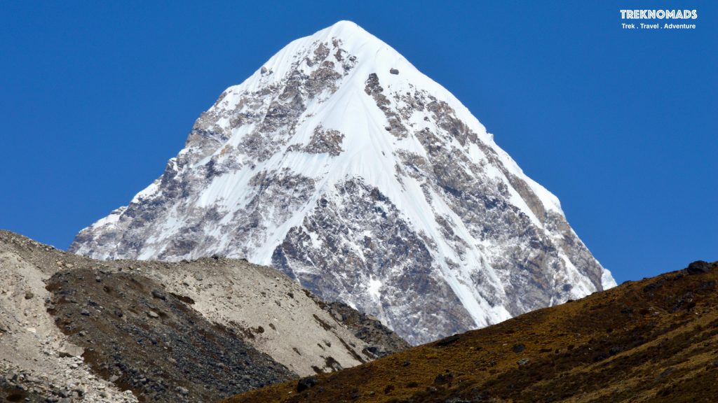
Before we reach Thukla, Mount Pumori or Pumo Ri (7,161 M) gives us company on the route. Mount Pumo Ri is in next to the Everest Base Camp (from the Nepal side). During the 1951 reconnaissance mission to climb Everest by Eric Shipton, Sir Edmund Hillary and team – they had climbed on Pumori to observe the entire Everest Summit Route. Which paved the way for the legendary first accent by Sr Edmund Hillary and Tensing Norgay in 1953. Pumo Ri means “the mountain daughter” in the Sherpa language.
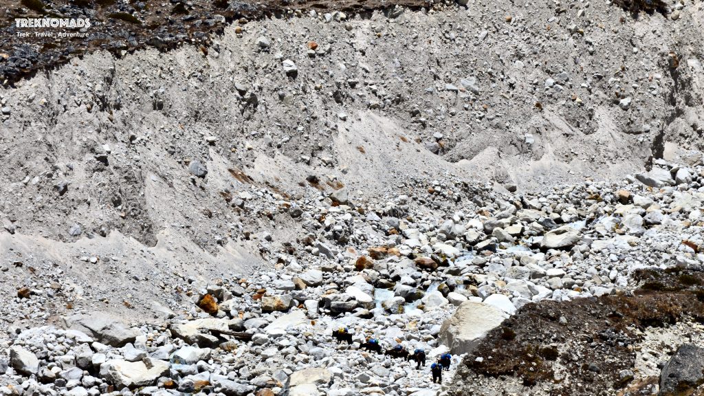
Just before we reach Thukla, we have to cross this stream. This stream directly flows from the mighty Khumbu Glacier. Look how tiny the yaks are in front of the boulders.
Thukla-Dhukla to the memorial site also known as Thukla Pass or Thugla (4800 m). This is one of the hardest climbs while going towards Lobuche. Generally, hikers have their lunch at Thukla. This 45 mins to 1-hour climb is one of the toughest – esp after lunch. Once we reach the top, we come to the Everest Memorial Site.
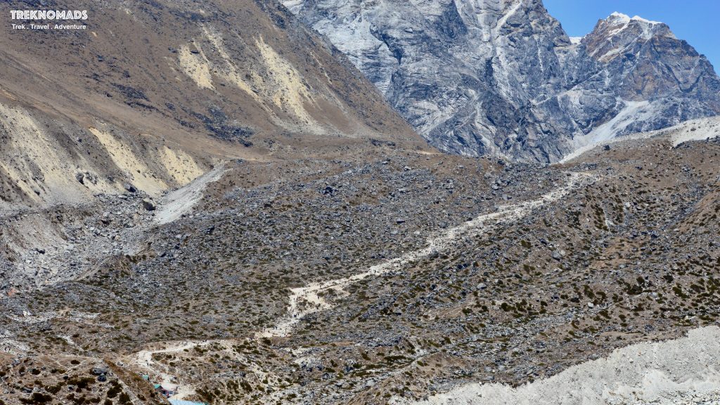
Day 8: Lobuche to Gorakshep
The mighty Nuptse (7,861 M) from Lobuche. When we reached Lobuche, the previous evening, we started feeling cold and altitude. It felt like we were inside a giant freezer. From this viewpoint, Nuptse covers Lhotse and Everest. We get a glimpse of Everest only after we reach Gorakshep.
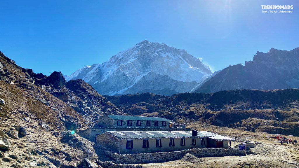
We started walking towards Gorekshep early in the morning after breakfast from Lobuche. Ironically, our tea house name was “Oxygen Bar” at Lobuche. So we stayed at the oxygen bar with a blood oxygen saturation of 80%!
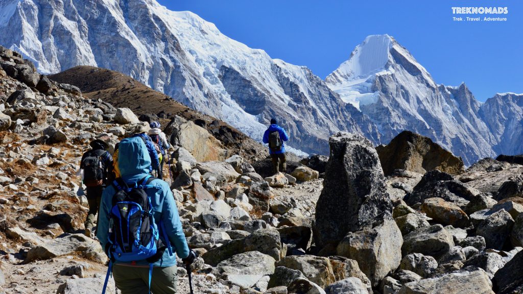
The route from Lobuche to Gorekshep is tough and tricky. The route is flat to start with. On our right is the mighty Khumbu glacier. We kept on walking slowly but steadily towards Gorekshep.

After walking for an hour, we get to this steep climb. That tested our fitness at 5,000 meters. We used to take breaks every 10-15 meters. However, in the front, we have mount Pumo Ri and towards the right, we had mount Nuptse to support us. We had to cross a glacier (which has mostly boulders and loose gravel) before reaching Gorekshep.
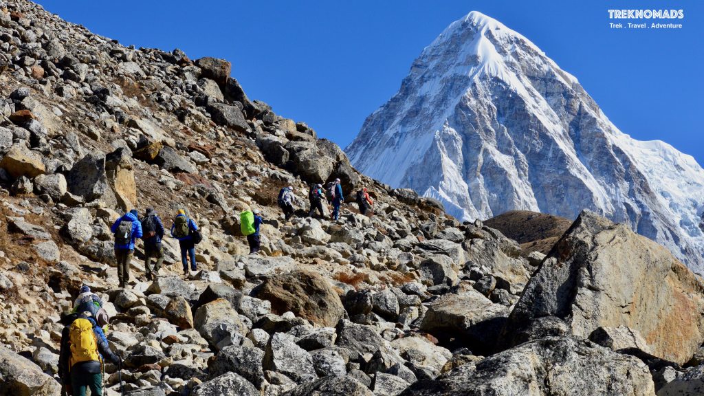
The famous Kala Patthar summit (5,644 M). Kala Patthar means black rock. The Kala Patthar hike is one of the most toughest. We start from Gorekshep (5,164 M) and reach the summit. The summit provides the best views of Everest, Nuptse, Lhotse and the surrounding peaks. Generally, this is climbed once you reach Gorekshep in the afternoon (for sunset) or early morning (for sunrise).
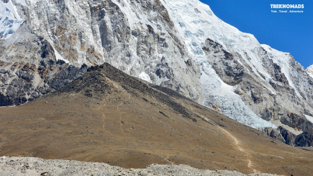
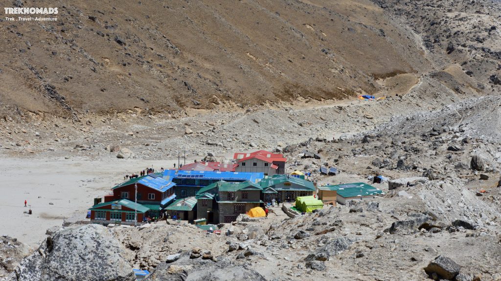
Gorakshep, the tiny village before the Everest Base Camp. The village is at a height of 5,164 M. The village has a few hotels and it is required to stay here before we go to the EBC and Kala Patthar Summit. On the left side, we can see the base of Kala Patthar. Towards the right is the Everest Base Camp Route. On the right side, we have the Khumbu Glacier.
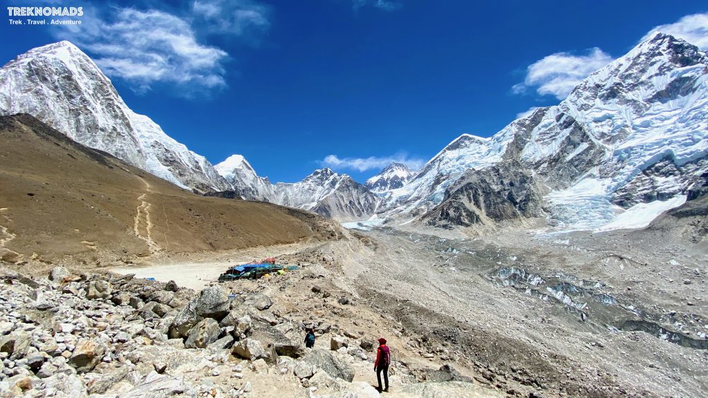
This was our first view after a strenuous climb and crossing a glacier. The picture gives us a panoramic view of the entire region. On the left is Kala Patthar, behind that we have Pumori. Towards the right, we have Khumbu Glacier, Nuptse, the summit pinnacle of Everest and at the centre, we can see the base camp somewhere.
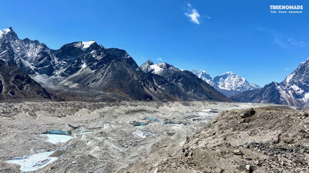
The mighty Khumbu Glacier. This is the other side of the picture. Towards Lobuche. We can see Cholatse in the background.
Day 9: Gorakshep to EBC
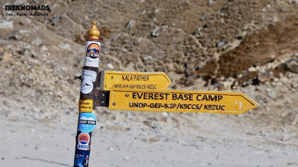
Direction marker to the Everest base camp and Kala Patthar.
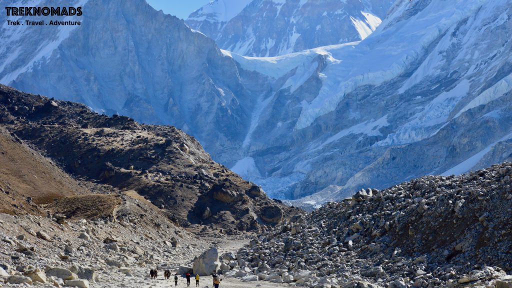
The next day, early morning, we started our hike towards the Everest Base Camp. The route is rocky with a few inclines. It would take around 2-3 hours from Gorekshep to reach. We walk on the left edge of Khumbu Glacier and then descend into the base camp – which is also on the glacier.
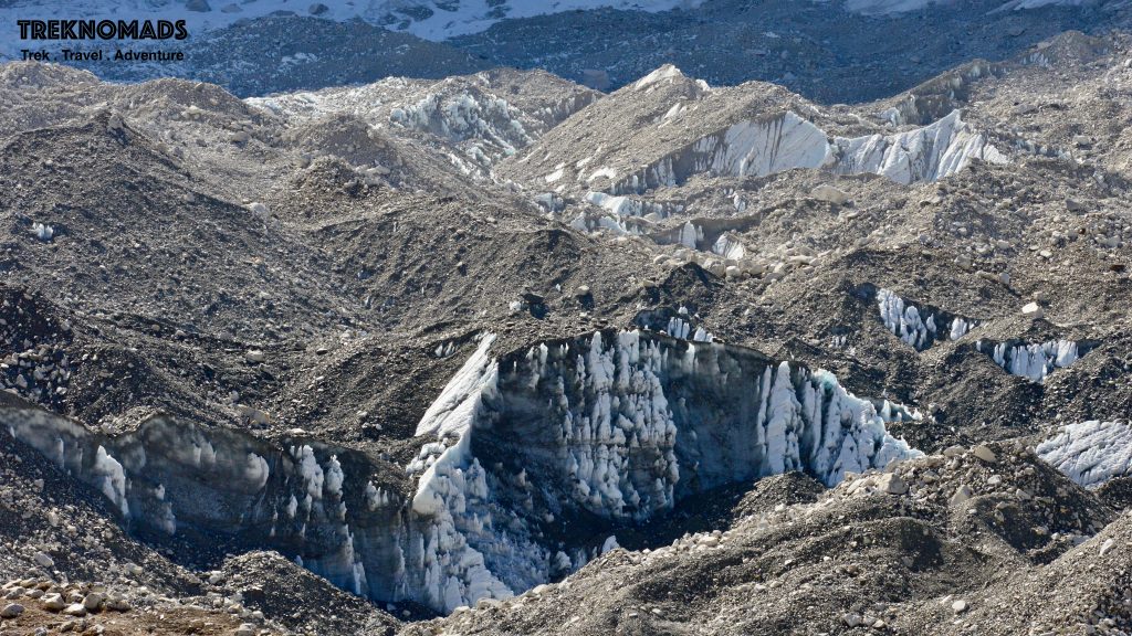
The ice pinnacles of the Khumbu Glacier. These were massive, completely covered in the soil – while revealing their white colour once in a while.
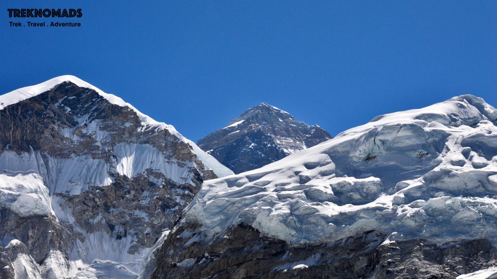
The Mighty Everest.
The Everest base camp. This is like a tiny village with so many colourful tents. They have a lot of facilities at the Everest Base Camp – 2 helipads, showers, hot water, food from all over the world and such. We were greeted with a summit completion cake by our trekking partner! Climbers who are attempting the summit generally stay here for 2 months – waiting for the weather window and acclimatising to the altitude.
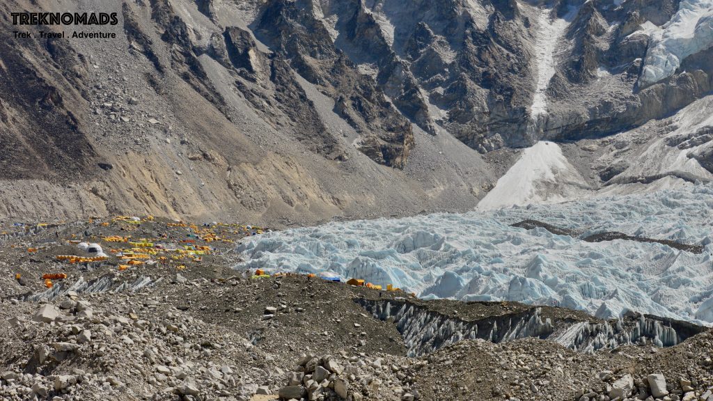
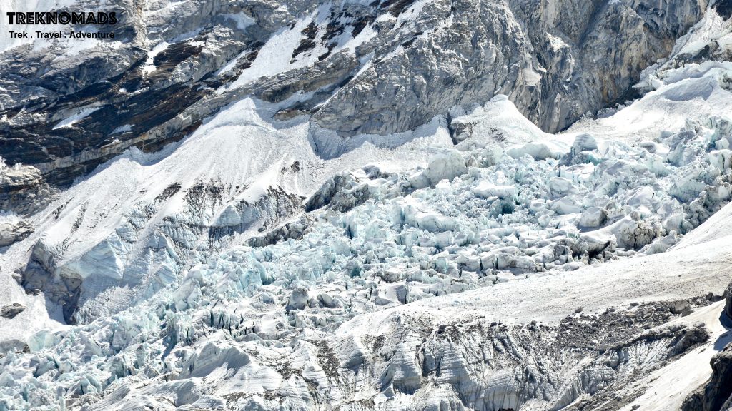
Khumbu Ice Fall. While attempting the Everest or Lhotse summits, the climbers have to cross this section. This is one of the most dangerous and tricky sections of the entire summit attempt. And this is massive. Zoom in and try to find climbers in the picture!
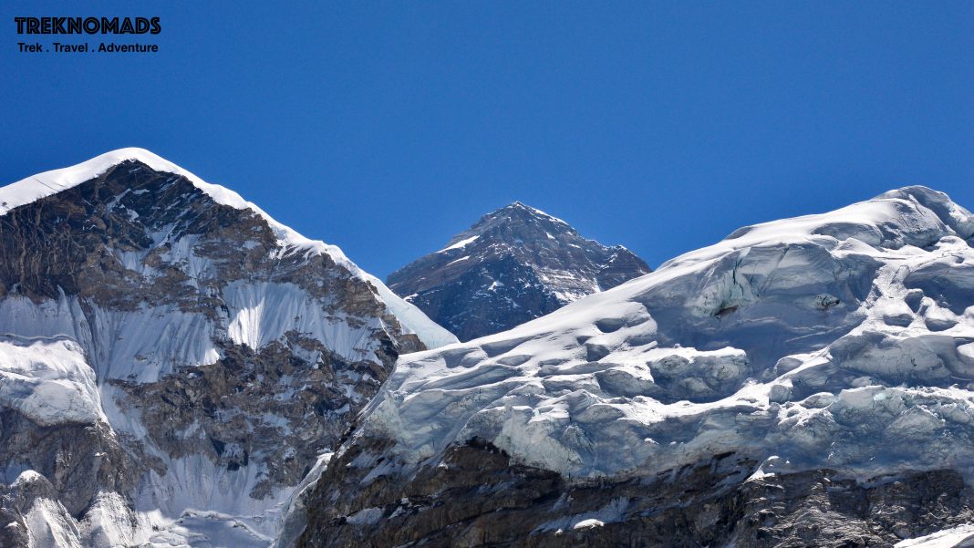
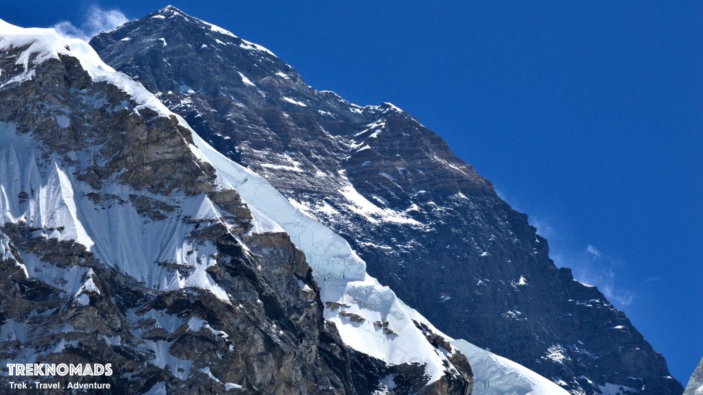
The closeup of the Everest Summit. We can see the south summit, balcony and the summit in this picture. During the first ascent of Everest, Sir Edmund Hillary and Tensing Norgay has a final camp near the south summit. One hell of a camp and night it would have been!
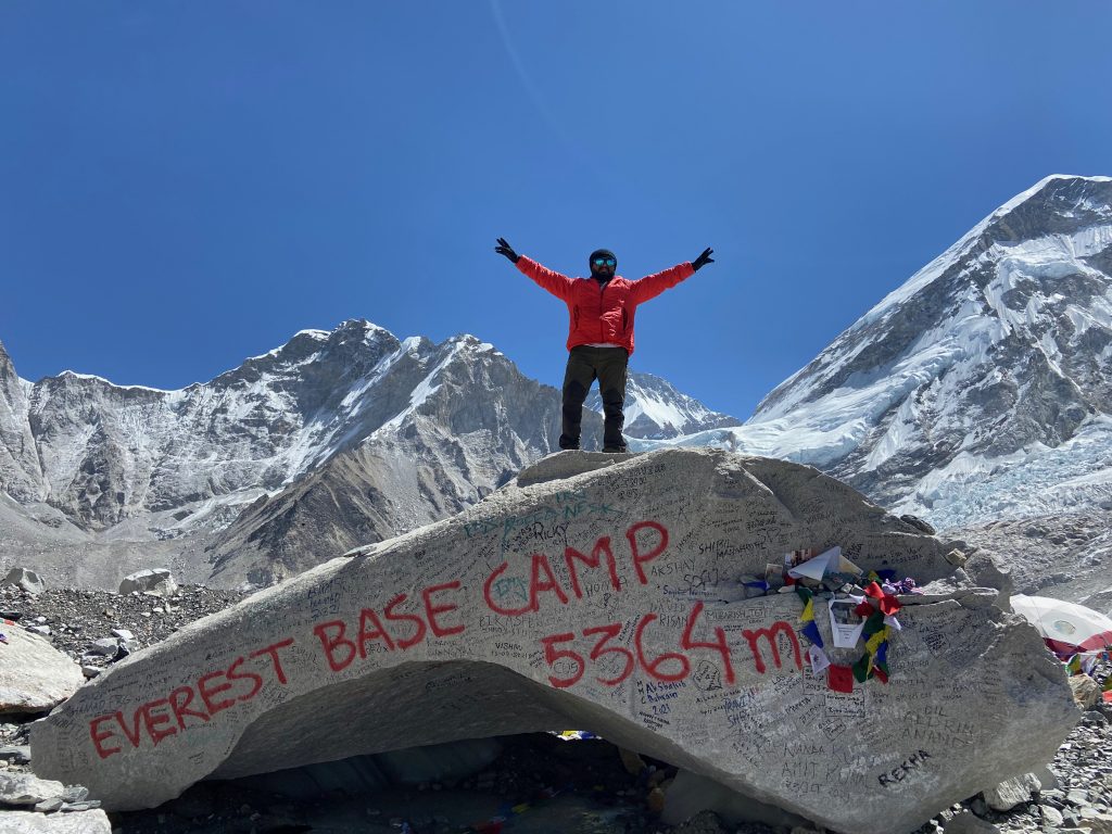
No better feeling than climbing on top of this rock and taking photos here.
Day 9: EBC to Kathmandu (via Helicopter)
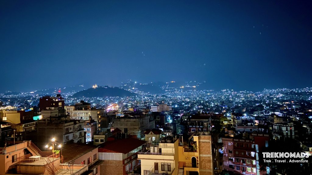
Finally reached Kathmandu. Generally, after the base camp, the trekkers reach Pheriche by evening or night. Later they trek to Namche Bazaar and Lukla. They take a flight from Lukla to Kathmandu. However, we took a helicopter ride directly from EBC to Lukla to save time. The helicopter ride from EBC to Lukla is another life experience. We traced our steps in reverse from the Helicopter window.
DO Visit our EBC Trek resources!
