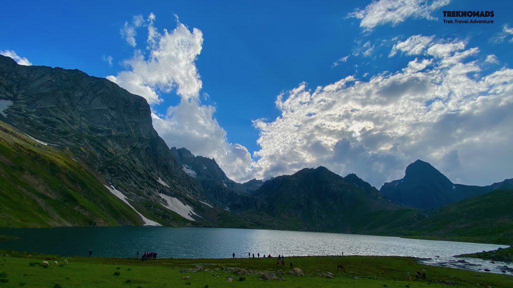
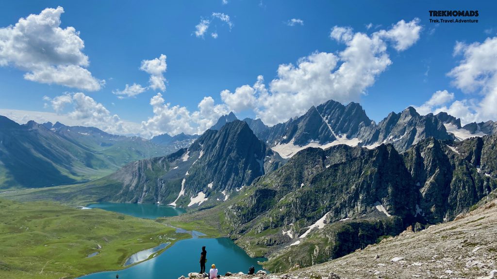
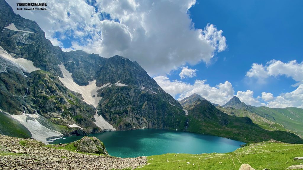
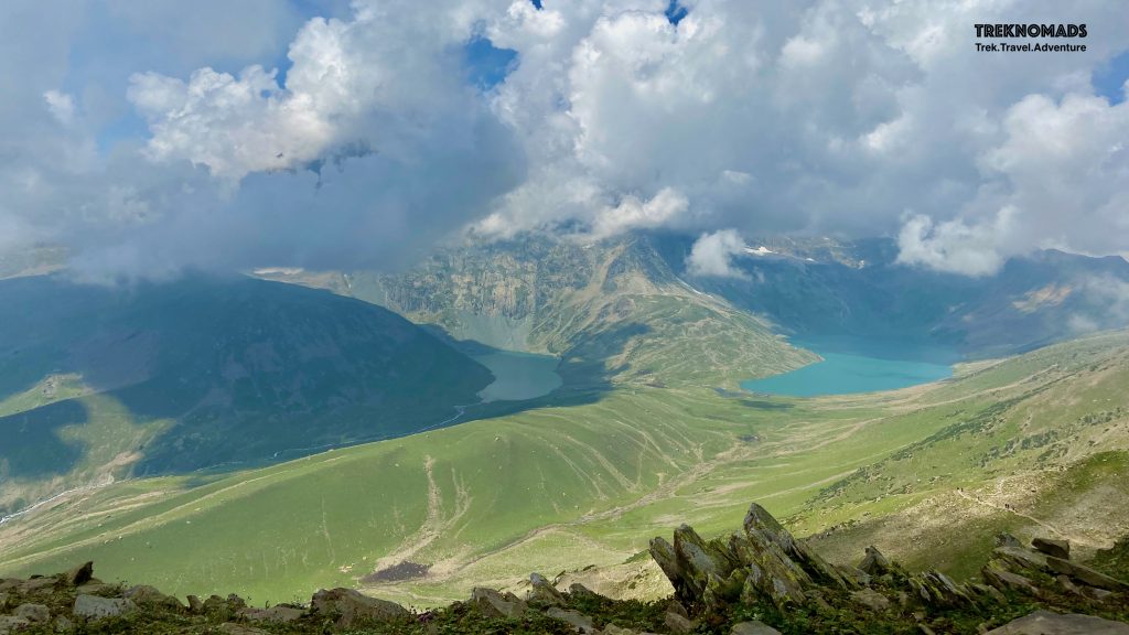
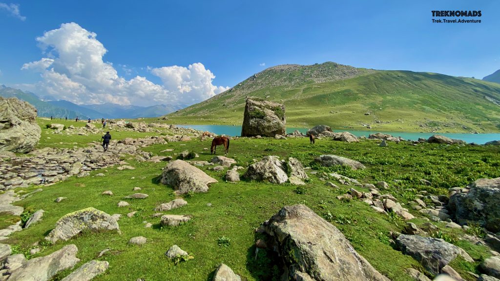
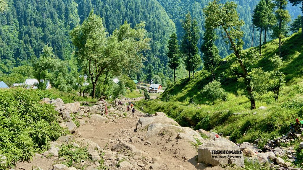
Vishansar and Kishansar Lake together in the frame from Gadsar Pass
We recently did the Kashmir Great Lakes trek and we were spellbound. Not just by the way the trek was, but by the eternal beauty that the trail has to offer. Which reminded us of a certain saying:
“Agar firdaus bar ru-ye zamin ast Hamin ast-o hamin ast-o hamin ast” If there is heaven on earth
It is this, it is this, it is this!
We have heard the above lines multiple times in popular media. I have heard too. However, whoever has written these lines on Kashmir – was 100% correct. There is no parallel to the beauty of Kashmir (in comparison to whatever I have seen so far in my life). This blog is a very humble tribute to this great valley, its people, culture, and nature.
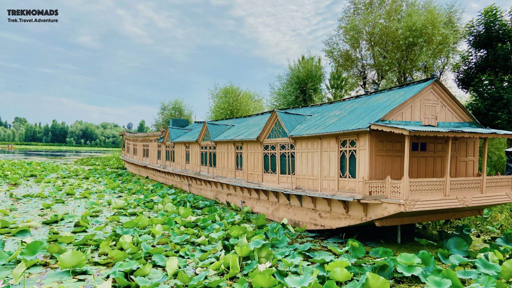
We started our journey from Bangalore on 6th August 2021. We were tired of the lockdown, corona, and sadness all around us. We were looking forward to this trek. We were joined by other group members from Gurgaon, Pune, and Goa in Srinagar.
COVID-19 Pre-Requisite to enter Kashmir:
A negative RTPCR was mandatory at Srinagar airport. We had taken one before 72 hours of travel. However, on landing, we were told that a 48-hour certificate was required. We had to wait for 30-45 mins for registration and were asked for a RAT (Rapid Antigen Test) after providing our contact details.
The above information may change from time to time. So please DO NOT consider it as an official advisory. Please take updates from the government sources.
Kashmir Great Lakes trek itinerary:
Following was the day-wise itinerary of our trek.
6/Aug/21 – Travel from Bangalore to Srinagar, Stay at Houseboat
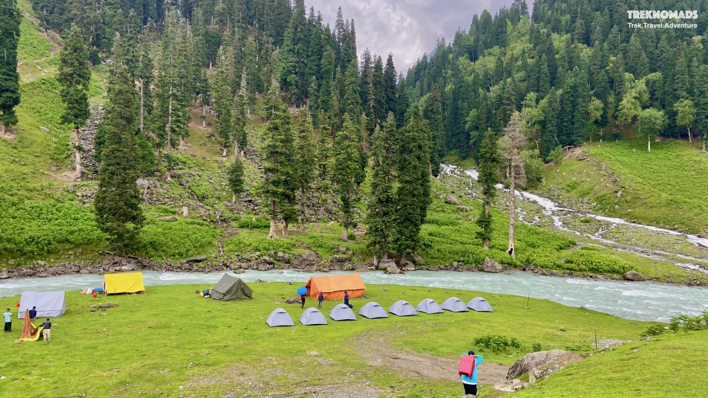
7/Aug/21 – Srinagar to Sitkari Campsite (2,800 m)
8/Aug/21 – Sitkari Camp to Nichnai Camp Site (3,600 m) – Trek Distance ~13 km
9/Aug/21 – Nichnai Camp to Vishansar Lake (3,710 m) – Trek Distance ~10 km
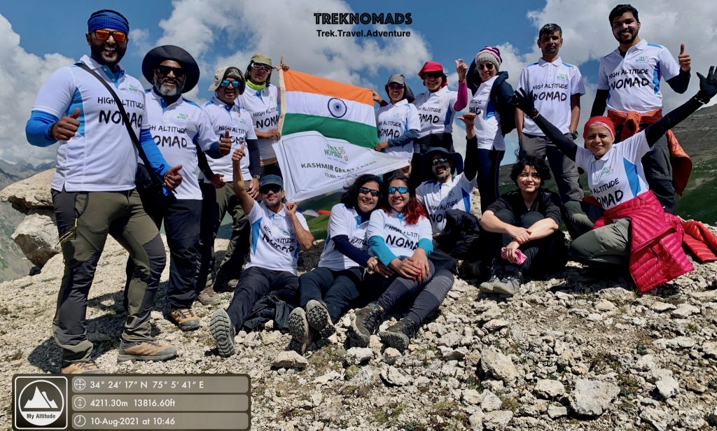
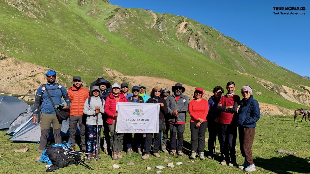
10/Aug/21 – Vishansar Lake to Gadsar Camp – via Gadsar Lake and pass (4,211 m) – Trek Distance ~18 Km
11/Aug/21 – Gadsar Camp to Satsar Camp – via Satsar Lake, Nanga Parbat View point – Trek Distance ~14 km
12/Aug/21 – Satsar Camp to Gangbal Twin Lakes – via Gangbal Pass (4,150 m) – Trek Distance ~15 Km
13/Aug/21 – Nandkol Campsite to Narnang Village to Srinagar – via Tiger Face – Trek Distance ~12 km
14/Aug/21 – Fly back to Bangalore from Srinagar
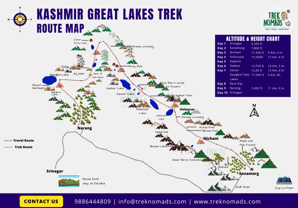
Kashmir Great Lakes trek route map that was followed:
Best time to do the Kashmir Great Lakes trek:
With houseboat stay, Wazwan cuisine, beautiful valleys, mountain passes, over 100+ km of trekking, glacial streams, rocky terrain, grassy terrain, intermittent rains, camping – this trek had almost everything a trek can offer. In July, there is a lot of ice on the trail. August is comparatively warmer – but it may rain intermittently. You can read more here.
Kashmir Great Lakes trek photoblog – A visual journey:
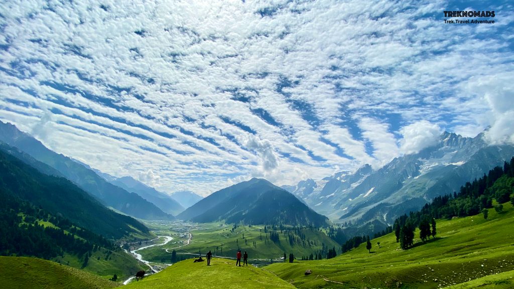
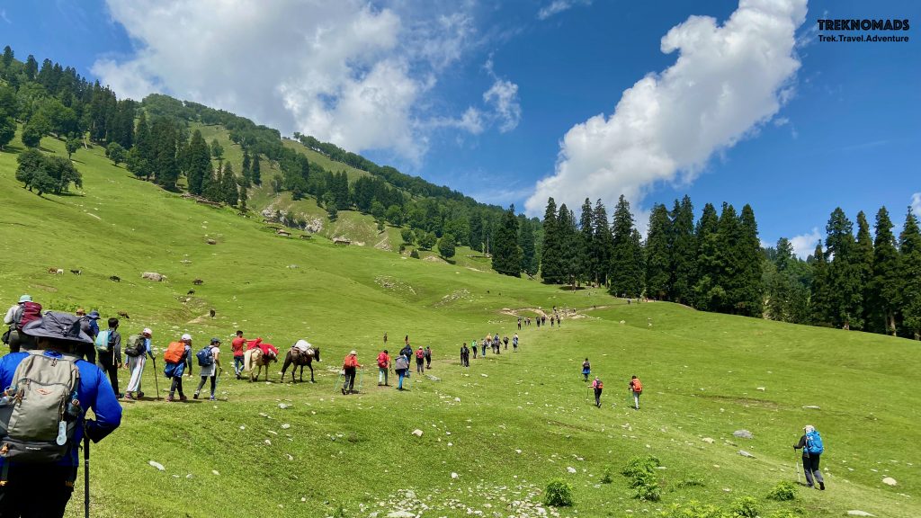
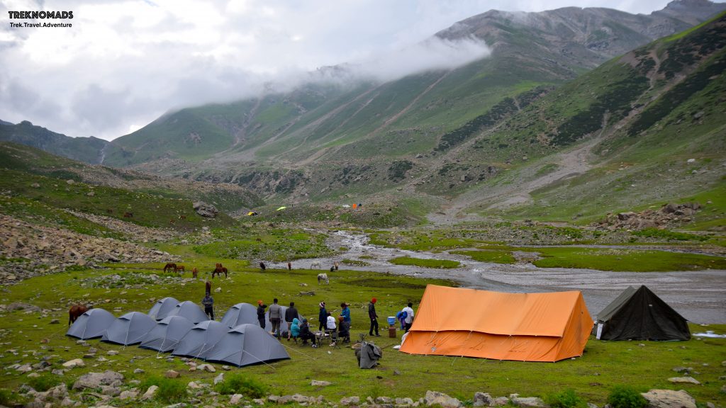
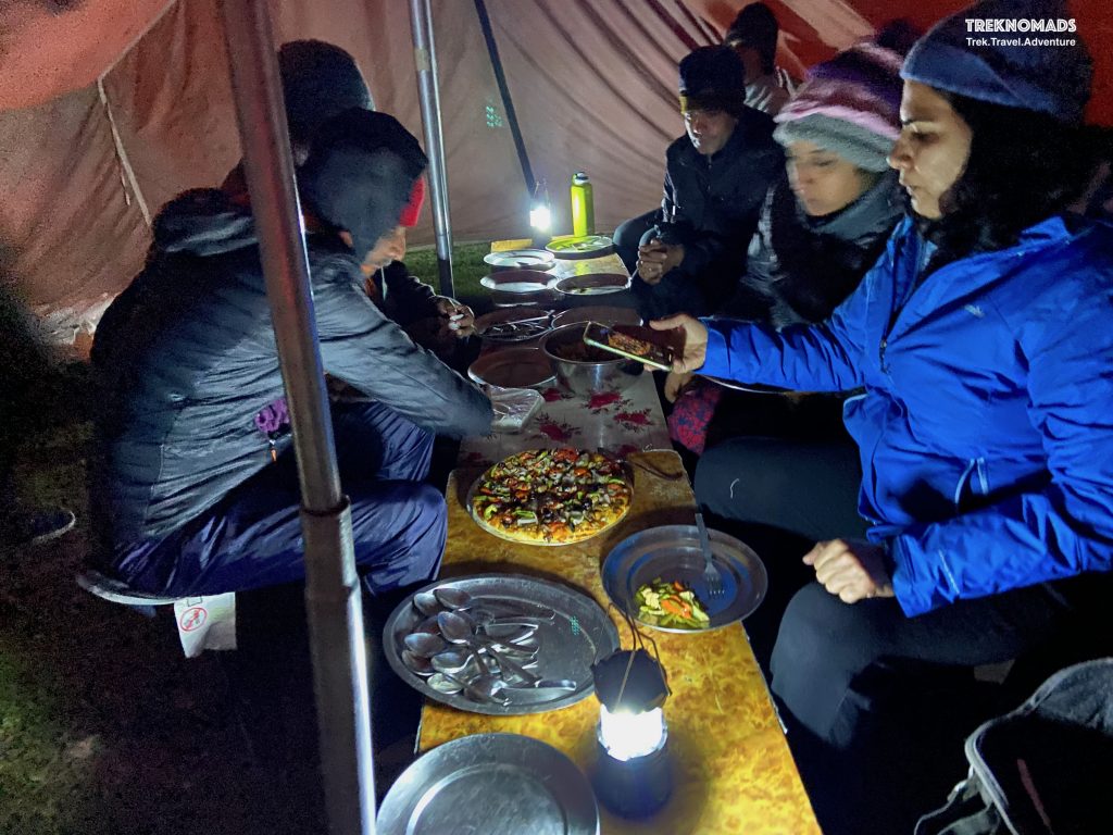
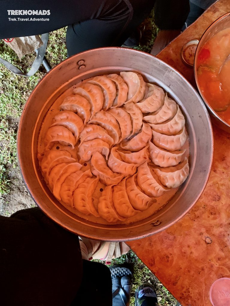
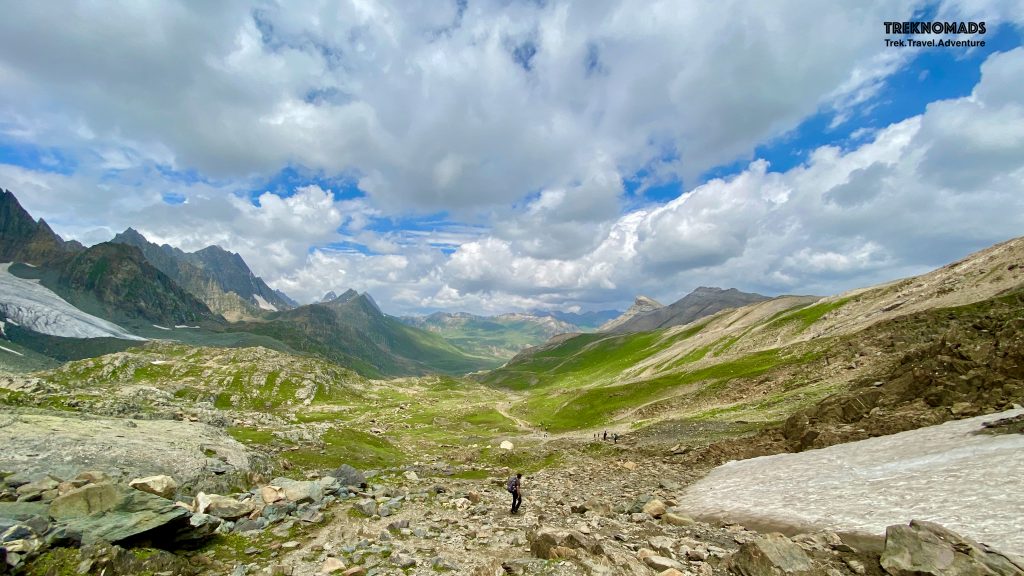
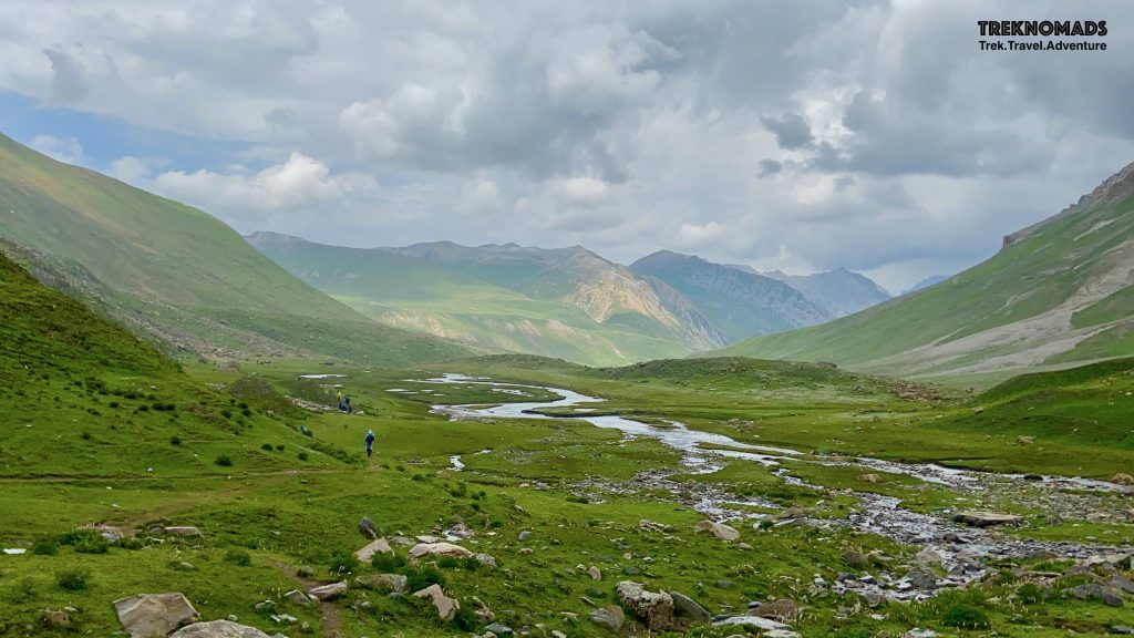
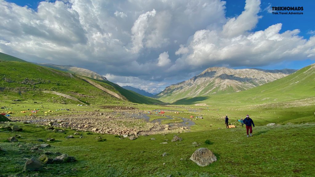
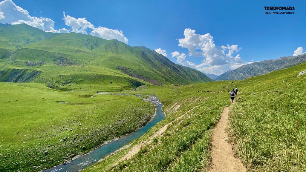
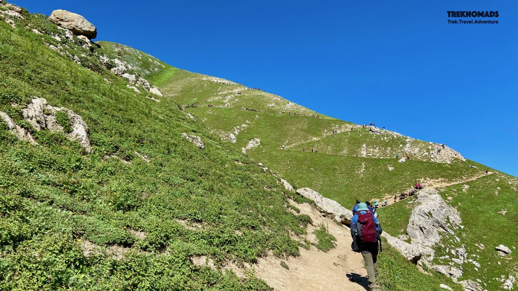
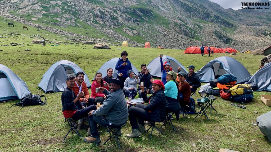
Kashmir trips are incomplete without staying at a nice, comfortable, cosy and hospitable houseboat. We stayed in one of such beautiful houseboats in Srinagar, near Daresalam on 6th Aug.Our first campsite at Sitkari – 2 km before Sonmarg. All Campsites during our trek had beautiful glacial streams and a surreal environment.Looking back at our campsite and gorgeous surrounding peaks. We had walked around 2kms from the campsite. on left, we can see Sonmarg.The initial first km of the trail. It was a hot and sunny day. But with fresh legs and enthusiasm, we started our long trek.After crossing the tree-line, we reached Tabletop. We had hot Maggie, our packed lunch and started descending to this beautiful and expansive valley. We had to trek from another 6-7 km to reach camp 2 – the climb was gradual after descending from the tabletop.Our Camp 2 – Nichnai camp. This camp was at an altitude of around 3,600 meters above sea level. We had a beautiful and cold glacial stream next to our campsite. It was surreal but tiring on day 1.Our team enjoying freshly backed pizza at Nichnai Camp.We had an awesome cook – who prepared pizza and momos at around 3,600 meters altitude!Nichnai Camp the next morning. We were ready to cross our first pass at 4,100 meters today.
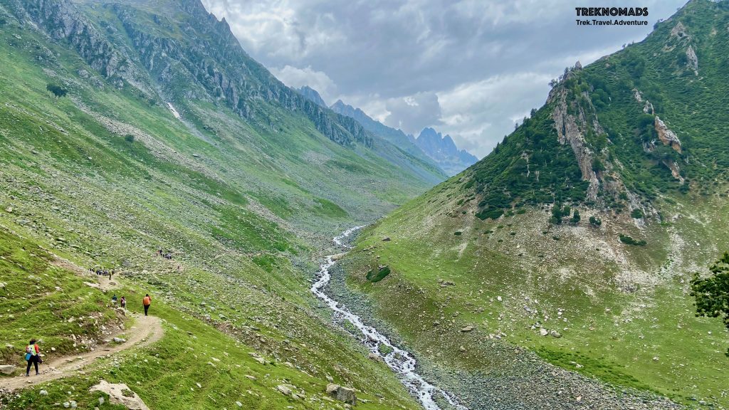
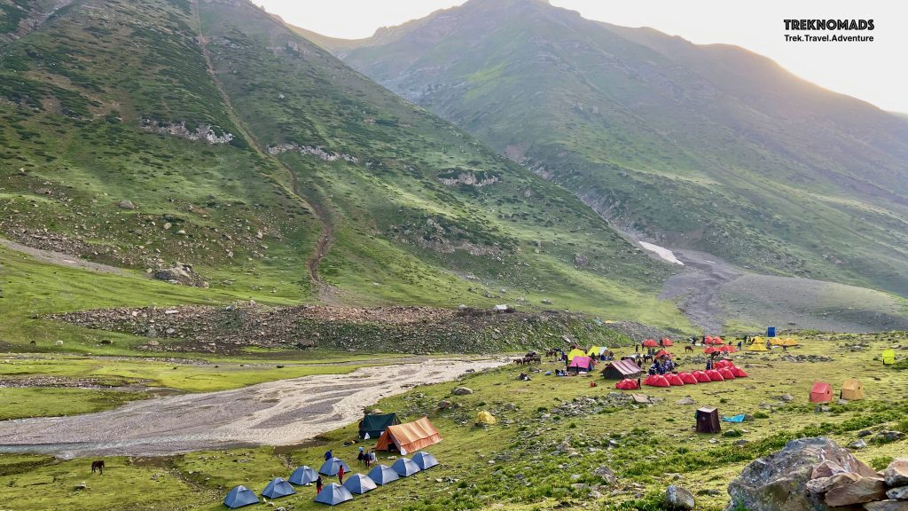
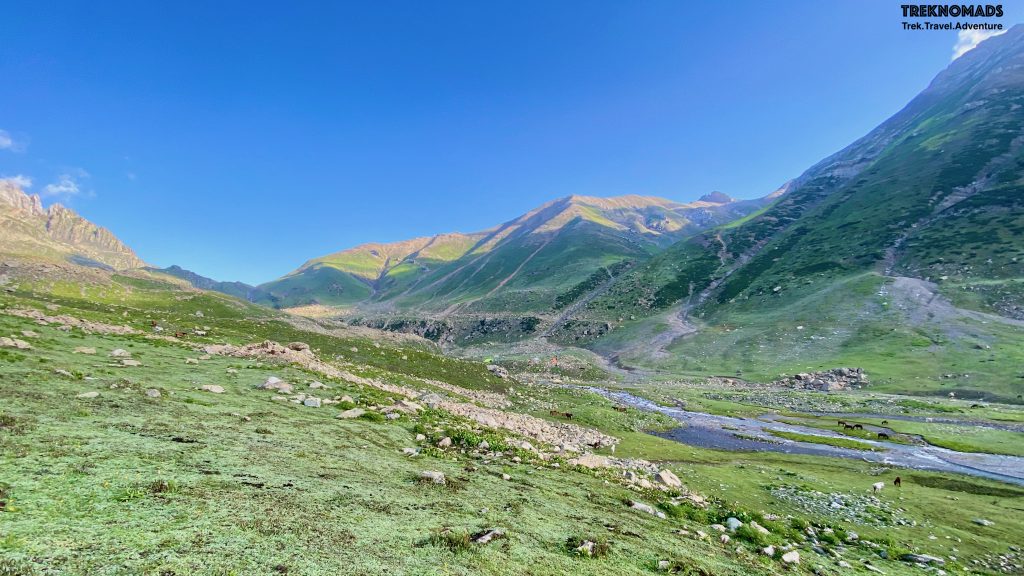
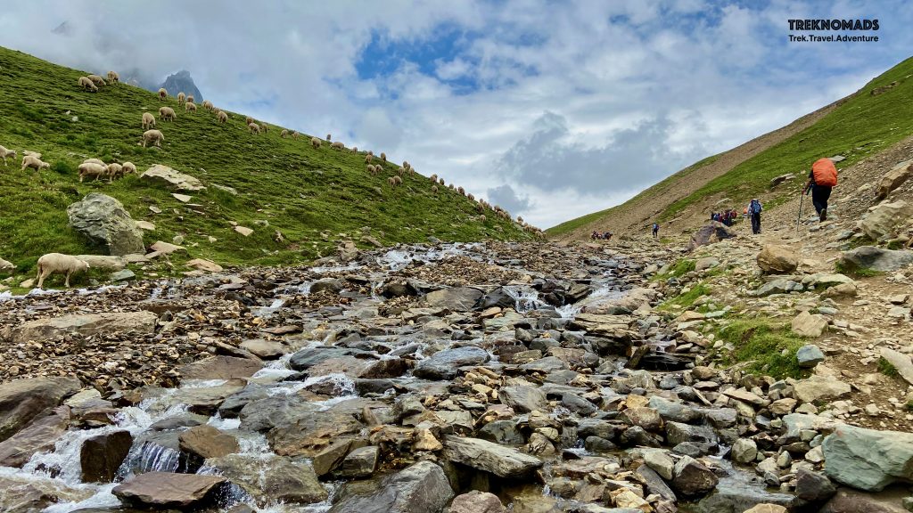
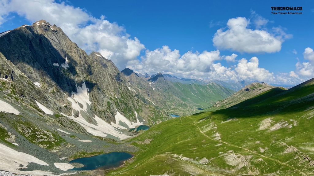
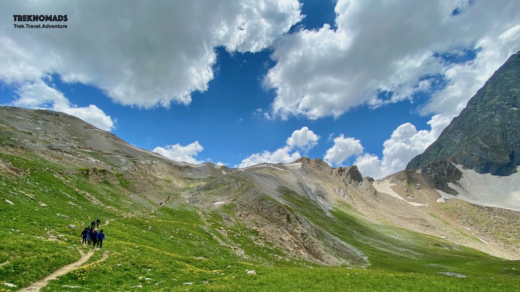
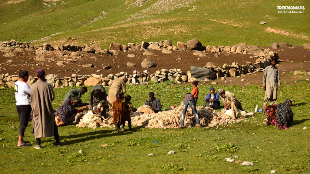
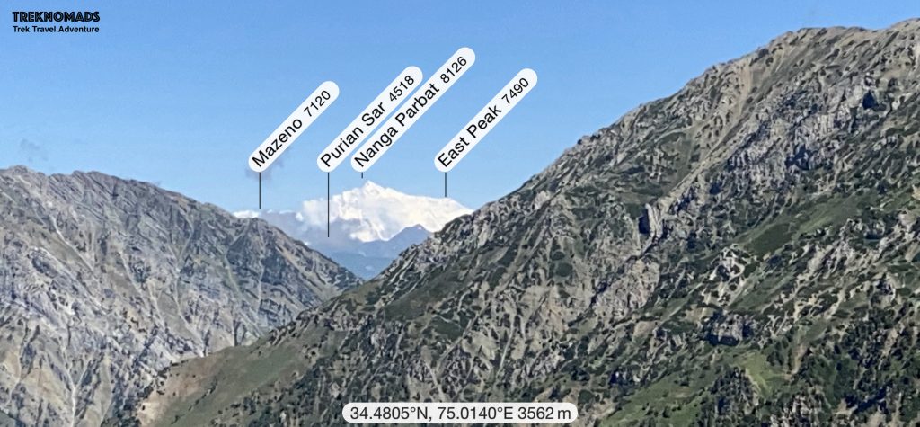
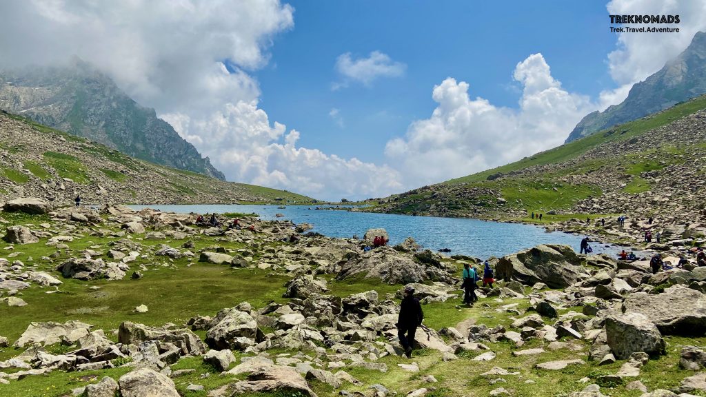
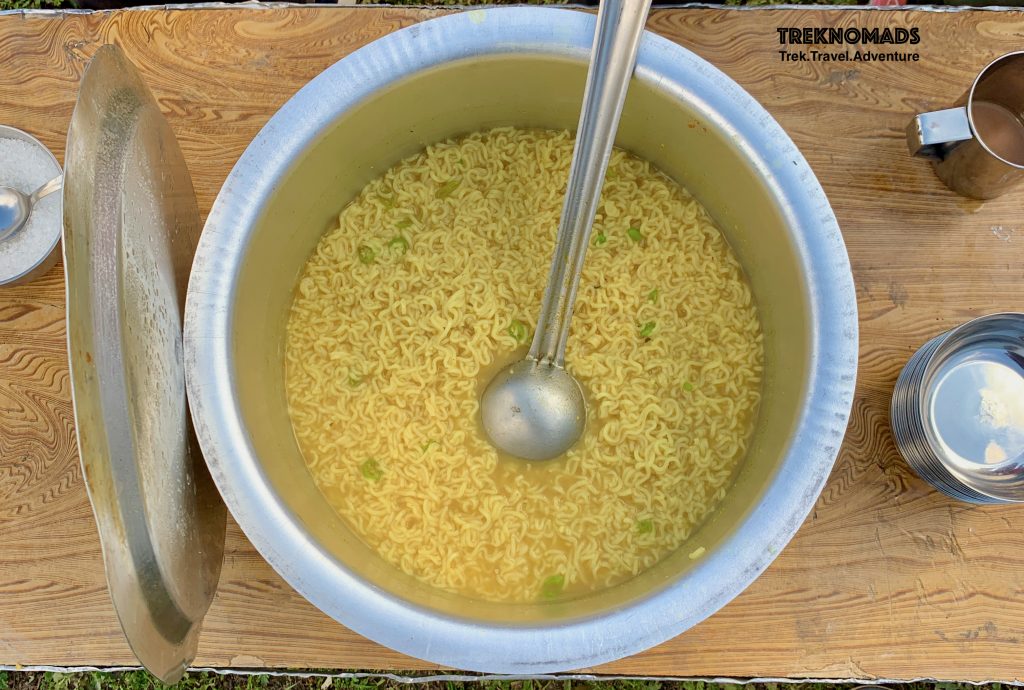
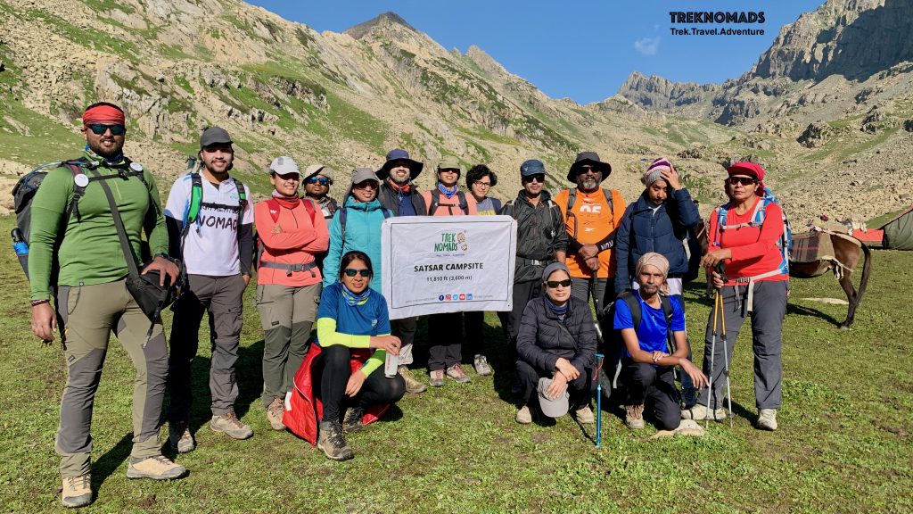
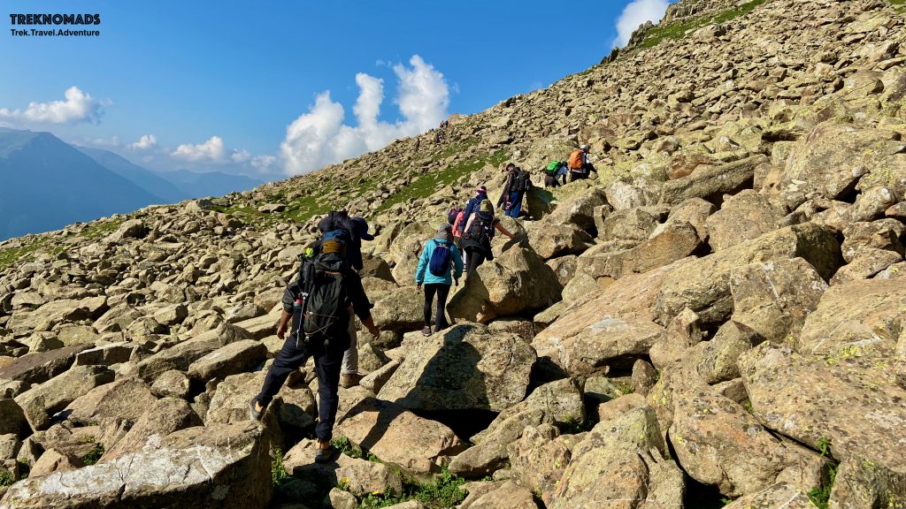
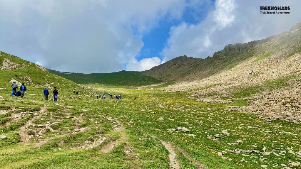
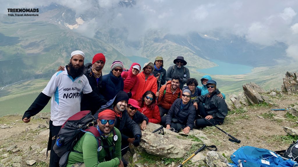
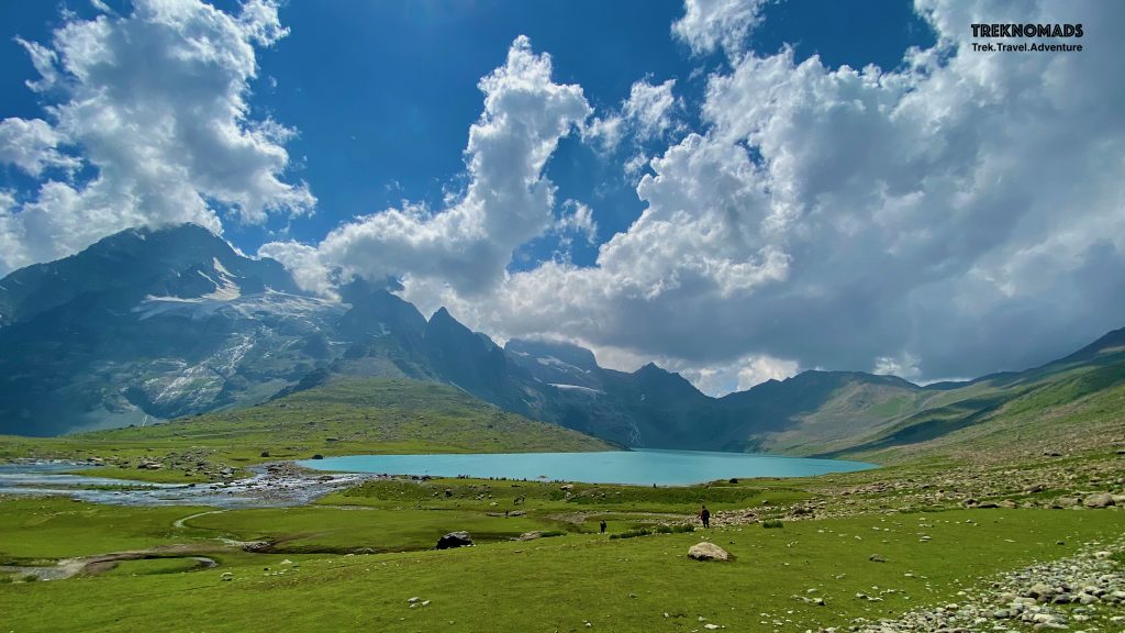
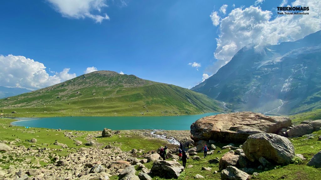
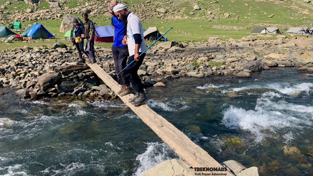
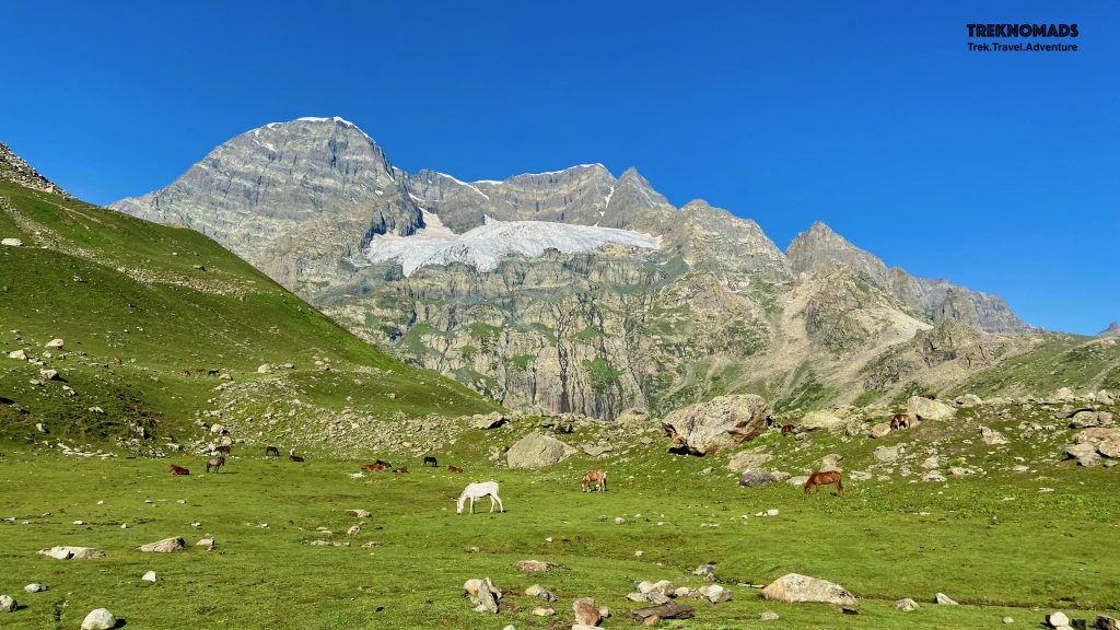
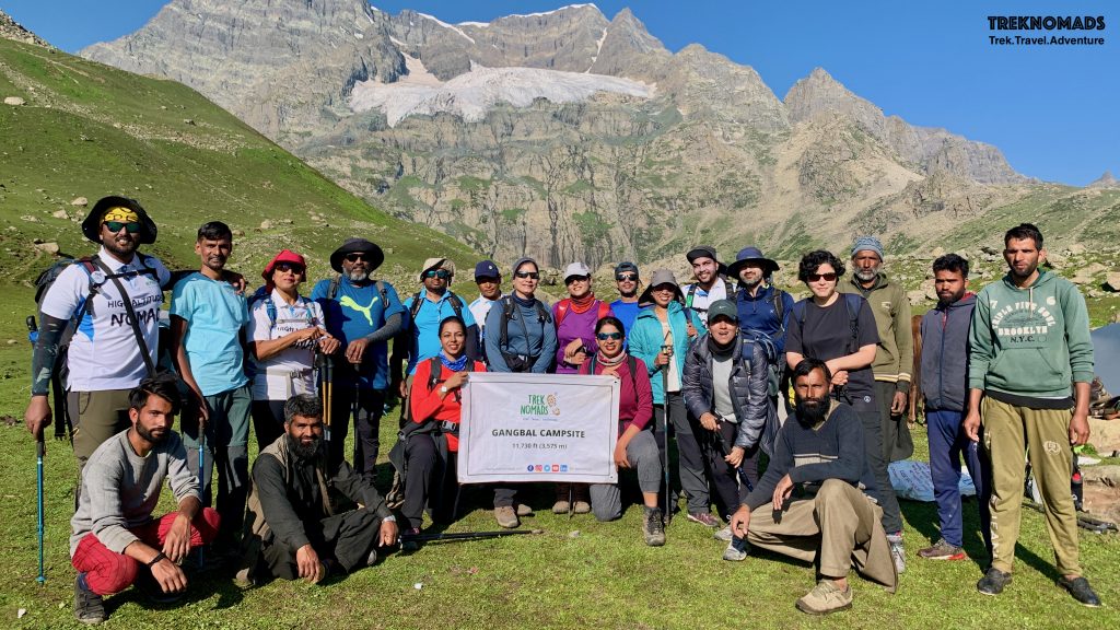
Start of Day 2. The Nichnai pass which we were to cross is towards the left of the picture. There was a waterfall next to the pass, which we had to cross. From our campsite, this looked very daunting. However, with a new day, we started climbing towards this pass.We were near the Nichani Pass. The waterfall which we saw from our camp, was flowing next to us. We were at almost 4,000 meters above sea level. After 1 km of flat at the top and a short climb, we were at the Nichnai Pass.After crossing the Nichnai Pass, we came across a beautiful trail while descending. The trail was a “walk in the park”. We walked on the soft grass almost the entire trail. Our camp was around 4-5 km away (near Vishansar lake) from here.Beautiful landscapes – Towards Visansar Campsite.Hiking towards Vishansar Lake. It was 50 meters from our campsite.The gorgeous Vishansar Lake.Our group posing at Vishansar Lake. We had an awesome, friendly, and lively group. Our campsite was just 10 mins walk from the lake. There is a small stream overflowing from this lake – which passed next to our campsite. The stream was our main source of water.Vishansar and Kishansar Lake together in the frame from Gadsar Pass. The lake on the top is Vishansar Lake.A proud moment – the highest point in our trek. Gadsar Pass at 4,211 Meters above sea level.The other side of Gadsar Pass. Gadsar Lake is the third of the 3 lakes seen in the pic.The Gadsar pass is seen towards the left of the photo. The height looks smaller in this pic.The mighty Gadsar lake is in the background. We had our packed lunch at this picturesque location. The lake is huge and the photograph does not portray the magnitude of the surroundings.The Gadsar Lake. This was a huge lake and really pristine. We had to walk around 6-7 km from this lake to reach our next campsite.Towards Gadsar Campsite. This day was our longest. We trekked for around 19 km and crossed Gadsar pass at 4,100 meters above sea level.Next Day. Group posing at Gadsar Campsite. We were ready to trek to Satsar lake and the campsite. If lucky, we would also see the great Nanga Parbat – which is the world’s 9th highest mountain.Sheep shearing in process. These shepherds were experts at it. The sheep were co-operating as they wanted to get out of the woollen coat in this heat.Going towards Satsar Lake and Campsite. A steep climb around 3kms from the Gadsar Campsite.Our first glimpse of Nanga Parvat (8,126 meters) – the world’s 9th highest mountain. The mountain is also called a “killer mountain” due to the high mortality rate during climbing expeditions. This mountain is also shown in the movie – Seven Years in Tibet (Brad Pitt).A zoomed version of Nanga Parbat and surrounding peaks.Towards Satsar Lake – after bidding farewell to Nanga Parbat. Satsar Lake is a collection of around 7 lakes. The terrain became rocky after we entered the Satsar Gali.At Satsar Camp – the team enjoying hot tea and maggie after a tiring trek of the day.Maggie anyone? We had this piping hot maggie at Satsar Campsite. A much-needed fuel after a gruelling trek.Group posing at Satsar Campsite. This was going to be a tricky trek. We had to cross a boulder section for 1 to 2 hours and then Gangbal pass (~4,150 meters). The total distance we would cover this day would be around 15 km.We had to cross around 1 km of the boulder section to go towards the next pass. This section was really tricky to cross. Somehow we managed to cross this at a slow and steady pace.Gangbal Pass – around 4,100 meters above sea level. This will be the last pass we would cross.Twin Lakes from the Gangbal Pass. A great view of Gangbal and Nundkol lakes. Gangbal is towards the right and is a bigger lake.Our group posing at Gangbal Pass. We can also see twin Lakes – Gangbal and Nundkol lakes. Gangbal is towards the right and is a bigger lake.Gangbal Lake.Nandkol Lake. We had gone to Gangbal lake after climbing down from the pass. After sightseeing and photography, we walked towards Nandkol lake. Our campsite was near this lake.Beautiful landscape at Nandkol Lake. We visited Gangbal lake after descending from the Satsar Pass and then crossed over the ridge to Nandkol lake.River crossing at Nundkol lake. This crossing was very tricky and scary. Just after we crossed, the locals put another log – supporting the first one. Trekkers can cross the stream further down – where waters are knee-deep but icy cold.Mt Harmukh (5,41 meters) is the main source of Gangbal and Nandkol lakes. This is the 2nd highest mountain in this region. We camped at the base of this mountain. There are a lot of small insects at this campsite. So use lights inside your tents wisely.The team at Gangbal Campsite. In the background, we can see Mt Harmukh (5,41 meters).The final 400 meters. It was hot and sultry. We were happy and sad at the same time. The final descend after the maggie point – towards Narnag – was the toughest of our entire trek. The locals call this tiger face. It was a painful, long and tricky climb down.
That’s all for now. We have captured around 900+ pics of the trek. It was really a challenge for us to shortlist the best ones for this blog.
If you wish to know more about the Kashmir Great Lakes trek and for dates for Kashmir Great Lakes trek departures in 2022, click here